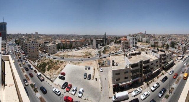
Which Jerusalem?
When one thinks of Jerusalem, the picture most people see is of the Old City inside the sixteenth century wall built by Sultan Suleiman al-Kanouni (Suleiman the Magnificent). However, the Old City represents less than 1 square kilometre of the entire 123 sq. kms of land Israel has treated as part of the entire municipality proclaimed a “united” city since 1967. The city borders have been extended greatly over the years, on the basis of strategic and diplomatic interests.
The boundaries of Jerusalem, originally promised a status under international protection in 1947, have followed a strange logic, ignoring the previous administrative area (the district of Jerusalem). Even Bethlehem was included in the new international zone of Jerusalem. When Zionist forces took over the region of Jerusalem and its surrounding area, in the First Arab-Israeli War of Palestine, and made West Jerusalem their capital in 1950, the members of the United Nations symbolically rejected the new state in various resolutions and based their embassies in Tel-Aviv or Haifa (as is still the case, to this day). From 1948 to 1967, Israeli authorities extended the municipal boundaries to the west, building on top of the ruins of destroyed or re-occupied neighbourhoods and villages, so that the total municipal area of West Jerusalem became 38 sq. kms. After 1967, they pushed municipal boundaries farther, judaising the newly conquered territories and legitimising their actions by referring to religious myths and the unique spiritual attachment of the Jewish people to Jerusalem and the “Greater Land of Israel.”
The Municipality of Jerusalem since 1967
A few weeks after the 1967 conquest, the Israeli government defined new boundaries for Jerusalem, which thereby increased to a total area of 70 sq. kms, including Palestinian East Jerusalem (an area of 64 sq. kms was appropriated to the north and south of the city). Around 34% of this Palestinian land was confiscated for the construction of huge Jewish settlements, while 54% of Palestinian land was designated “open green space,” which in effect kept it vacant for future Jewish use (leaving only 12% accessible to Palestinians - land already densely built on). Previously, the area of the municipality of Jerusalem was 44 sq. kms (6 sq. kms in East Jerusalem and 38 sq. kms in West Jerusalem). Twenty-eight Palestinian villages or parts of their land were integrated into the new municipality. The city borders were defined in response to political and demographic considerations: to include the maximum amount of uninhabited Palestinian land and the minimum Palestinian population. As a result, villages were arbitrarily cut in half (Anata and al-Issawiya), while others such as Abu Dis, al-Azariya, Hizme, Dahiyat al-Barid and A-Ram were deliberately excluded from the municipal boundaries. This over-riding development policy explains the curious layout of the city. In May 1988, another area of 15 sq. kms west of the city was annexed to the municipality. With its 123 sq. kms, Jerusalem has now become the largest metropolitan area in Israel. The total area of Tel Aviv is only 51 sq. kms. The dozen or more Israeli settlements: Ramot, Ramat Shlomo, Pisgat Ze’ev, Neveh Ya’akov, Atarot, Ramat Eshkol, French Hill, Ma’alot Dafna, Ras al-Amud, East Talpiot, Gilo and Har Homa have a combined population of some 225,000 settlers (compared to 300,000 Palestinians of East Jerusalem who live within the city boundaries set by Israel), all part of an “inner ring” of satellite settlements which consolidate the borders of the Jewish municipality. This “Greater Jerusalem” defines Israel’s future borders and prejudices Palestinian rights in any peace plan, while judaising formerly Palestinian East Jerusalem by putting irreversible facts on the ground. The governments of Sharon and Olmert have continued to build new Israeli settlements (e.g. Kidmat Zion in Abu Dis, Nof Zion at Jabel Mukabber). These settlements are still being pushed ahead, despite the various peace plans or ongoing negotiations of the Oslo Accords. In the Road Map of 2003 were strictures that Israel freeze all settlement building, especially in East Jerusalem, which all peace plans project as the future capital of Palestine. Since the Annapolis conference in November 2007, the number of new construction plans increased dramatically, which indicated that Israel is creating yet more facts on the ground to foreclose an agreement to share the city between Israel and a future Palestinian state. Once the Wall is completed around Jerusalem, 120,000 Palestinian residents of the Jerusalem Governorate will be cut off from their city. Meanwhile, under the first Obama Administration, President Obama achieved a 10 month settlement “freeze.” However, the actual planning processes were not frozen, so at the end of that period, settlement building went ahead four times faster, due to the backlog of planning that had come to fruition. Similarly, during the most recent “peace process” negotiations, at the end of August 2013, the Jerusalem Municipality proclaimed 1,500 new settlement units, issued eviction orders in the Old City to 28 families in order to take over their homes, levelled land on Mt. Scopus to create a national park that the authorities freely admit is planned to prevent Palestinian building (albeit currently being blocked by the Environmental Affairs Minister, Amir Peretz), not to mention making preparations for the building of a military college in Occupied East Jerusalem.
“Greater Jerusalem”
In 1983, in order specifically to tighten control over Jerusalem and a large part of the West Bank, the Israeli government developed the concept of a “Greater Jerusalem.” Its implementation, however, started only after the Oslo Accords’ signatures; construction work then accelerated fast: a number of settlements now form an “outer satellite ring” beyond the expanded municipal boundaries of Jerusalem. Among the satellite settlement cities are: Har Adar, Givat Ze’ev, Givon HaHadasha, Kiryat Sefer, Ma’ale Adumim, Efrata, the Etzion Bloc, and Beitar. These peripheral settlements are planned to accommodate more than 250,000 settlers within the next 15 years. The third largest, Ma’ale Adumim, has a population of some 40,000 (15,000 in 1991). Its land on a Master Plan (55 sq.kms. - more than Metropolitan Tel Aviv) now stretches all the way through to Jerusalem, a mere ten minute drive away, through a new settler-only (apartheid) tunnel blasted under Mt. Scopus and funded by the US administration during Oslo, when $3 billion was given to Israel for the road system in the West Bank (for “settler only by pass roads”). This settlement, more than any other, is the most serious, major stumbling block to the viability of a future Palestine, cutting the West Bank into two separated “bantustans” as it does, with neither contiguity nor road system joining those Palestinian northern and southern blocs, and preventing Palestinians from gaining access to Jerusalem, while restricting the natural growth of Palestinian East Jerusalem. In closing off the eastern access to the city by Palestinians, who are already unable to access the north and south due to settlements, checkpoints and the settler only road system, it also prevents the Palestinians from having contiguity from Ramallah via East Jerusalem to Bethlehem, which economic salient normally accounts for 40% of the Palestinian economy. The Wall, which runs along a similar route as the boundaries Israel set for “Greater Jerusalem,” will include 80% of all 550,000 Israeli settlers into the agglomeration of Jerusalem, while at the same time excluding 60,000 Palestinian residents from the city and giving Greater Jerusalem an almost 90% Jewish demography.
“Metropolitan Jerusalem”
The regional map of Jerusalem shows the ultimate stage of the settlements that will eventually incorporate a vast territory of which only 30% lies inside the Green Line. The projected metropolitan map includes the agglomerations of the autonomous areas of Ramallah and Bethlehem.
Things to see
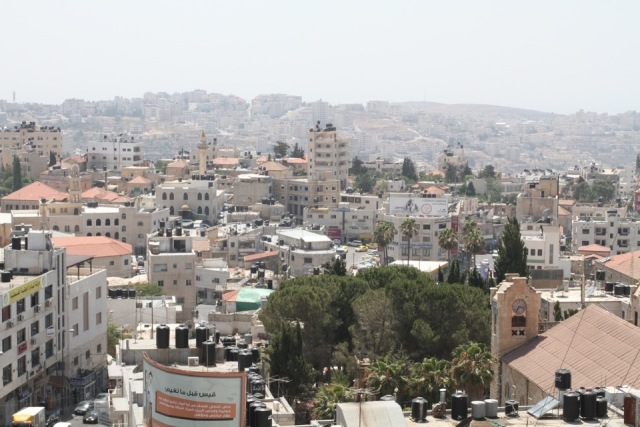
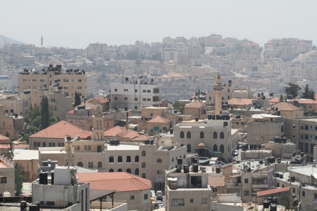
East Jerusalem East Jerusalem constitutes the oriental part of Jerusalem. As a result of the Israeli conquest of the western part of Jerusalem in 1948, the city was divided and a new designation came into being: East Jerusalem. Until 1967, East Jerusalem extended over an area of only six square kilometres, encompassing the walled Old City and its immediate neighbourhoods, Silwan, A-Tur, Wadi Joz and Sheikh Jarrah, among others. Today, the place denominated as “East Jerusalem” extends over a far vaster region, due to the Israeli municipality’s spread over the lands of the West Bank. It reaches from Kufr Aqeb, past Qalandia checkpoint in the north, to Beit Safafa in the south, where Bethlehem is walled out, having previously been part of the contiguous agglomeration of Ramallah-Jerusalem-Bethlehem.
The Old City
The Walls One of the best ways to have a good view of the entire Old City and its surroundings is to take a walk along its ramparts. There are two optional walks: from the Citadel to the Gate of the Moors (Maghribi or Dung Gate) or from Jaffa Gate to the Lion’s Gate (Damascus Gate lies halfway along this walk). The section between the Gate of the Moors to the Lions’ Gate along the Haram al-Sharif is closed to the public. One may leave the walk at each gate, but one may ascend onto the ramparts from two points only: outside the Citadel for the southern section of the wall and Jaffa Gate for the northern section. The contemporary four-kilometre wall is a copy of the Ottoman-built military wall, erected between 1537 and 1541 in the time of Suleiman the Magnificent. The wall followed traces of older, preceding walls in some places. The huge blocks of stone with their bevelled edges in the southeast corner date from the days of Herod’s Ramparts.
The Muslim Quarter
Damascus Gate is the heart of East Jerusalem; it is the place of arrival and departure of all Palestinian public transport (Musrara Square and Nablus Road). In Arabic, the gate is called Bab al-Amud (Gate of the Column), in memory of the Roman square once found there, which had a column at its centre, on which stood an enormous statue, probably of Emperor Hadrian. An entrance from the Roman plaza leading to the wall has been created for the benefit of visitors. It is a journey back in time, which leads to one of the most beautiful observatories of the Old City.
Al-Wad Street is the principal way leading from Damascus Gate to the Haram al-Sharif (Temple Mount) and then to the Western Wall (al-Buraq). During the Friday al-Dohour or mid-day prayers, a dense throng fills the narrow alleys. Somewhere between spirituality and temporality, this movement of the crowds leaving their place of prayer is one of the most impressive moments of a trip to Palestine.
Just down the road, a group of apartments overhanging a roofed passage (quantara) has belonged to former Prime Minister Ariel Sharon, since December 15, 1987. Their physical location perfectly symbolises Israeli state domination over Palestinian Jerusalem. Although Sharon has never lived here, the House of Sharon has always been heavily guarded: proof is the omnipresence of soldiers, armed settlers and surveillance cameras (more than 500 in East Jerusalem). At the end of the road, Jewish settlement in the Muslim Quarter reaches its climax. The road is full of tourist shops alternating with Jewish religious seminaries (yeshivot) and apartment buildings occupied by these Jewish settlers fired by religious nationalism, who are obsessively colonising the Old City, Sheikh Jarrah, al-Musrara, Silwan, Abu Dis, Ras al-Amud and Jabal Mukaber, in order to pre-empt Palestinian viable statehood in East Jerusalem, and to judaise the city by this form of bloodless ethnic cleansing. There are already 1,000 settlers living in the Muslim Quarter, amongst 31,000 Palestinians, who live in overcrowded and shabby conditions, direly in need of rehabilitation.
According to a July 2013 article in The Guardian newspaper: “A report, Jerusalem, The Old City, published in 2009 by the International Peace and Cooperation Centre (IPCC) – a Palestinian civil society organisation – said [settler organization] Ateret Cohanim was "taking the lead in the process of Judaising the Old City." Properties were acquired using three different methods, it said: claiming historic Jewish ownership and securing a court order to evict Palestinian residents; taking over "absentee property", or using underhand transactions, in which the identity of the buyer is concealed.” “A report on the Palestinian economy published earlier this year by the United Nations said housing density in the Muslim Quarter was almost three times as high as in the Jewish Quarter, and many Palestinian homes lacked running water and a proper sewage system. More than 80% of dwellings require major rehabilitation or urgent maintenance, according to the IPCC. Three out of four children in the Muslim Quarter live below the poverty line, and unemployment is more than 30%. Garbage collection is sporadic in these back streets, and there are almost no open spaces for children to play in. The use of child labour is widespread; the dropout rates from schools are high. Domestic violence and drug abuse is on the rise.”
“A major reason for the migration into the Old City is an Israeli requirement for Palestinians to prove that Jerusalem is their "centre of life" in order for them to keep their valued residency rights in the city, giving greater access to jobs, education and healthcare. More than 7,000 Palestinians had Jerusalem residency rights revoked between 2006 and 2011; faced with such a threat, thousands more moved from suburbs and villages outside Jerusalem back into the city – including the Old City – to secure their identity papers. Others, who found themselves cut off from the city centre by the vast concrete separation wall, moved into the Old City to avoid daily checkpoint ordeals.”
“On top of this, says the UN, Palestinians in the Old City are "caught between the frontlines of interaction with Israeli settlers and authorities on a daily basis and the frontlines of a struggle to preserve and assert Palestinian cultural and political identity and its Islamic and Christian roots. This has entailed a growing sense of siege and conflict for indigenous Palestinian residents, who perceive their lifestyles, livelihoods and social cohesion to be at risk in the discordant climate reigning in the Old City, with religious fervour easily degenerating into communal tensions."
In this part of the Old City, too, there are 28 Palestinian families who recently received eviction orders, due to the dangerously bad condition of their homes, which they are not allowed to renovate. The homeowners blame the settler-driven tunnelling under their homes; it must be said that Israeli take-over of the Old City of Jaffa, and its conversion into an artists’ colony for Israeli Jews, followed the exact same policies.
Souk Khan ez-Zeit is the busiest, most picturesque and colourful shopping street in the Old City. Above all, the souk is a popular market selling all food products used in Palestinian cooking - spices, dried fruit, herbs, coffee, freekeh (a wonderfood grain, containing 15% protein), pastries and sweets such as knafe - as well as more ordinary food supplies. Halfway along, the market street splits into two roofed passages; Souk al-Attarin, where there are many clothes shops, and Souk al-Lahmin, the meat market.
Ala’ ed-Din Street leads to the Haram al-Sharif and the African Quarter via the Inspector’s Gate (Bab al-Nazir). The African Quarter is actually inside two ancient Mameluke hospices: Ribat Ala’ ed-Din al-Basir (to the left, opposite the en-Nazir Gate), and Ribat Mansuri (to the right).
Bab al-Hadid (Iron Gate) Street
Street of the Chain Gate (Tariq Bab al-Silsila)
Given the popularity of holy places in Jerusalem and the freedom of movement of people throughout the entire Arab world under the Mamelukes, many devout Muslims chose to retire to the city, at the end of their days: because of this phenomenon, this road is lined by a number of Mameluke buildings, especially turba - mausoleums.
Khan es-Sultan.
Herod’s Gate (Bab al-Zahra)
The name Bab al-Zahra, “The Flower Gate,” refers to the rosebush overhanging the Ottoman arch. Christian pilgrims, seeking biblical souvenirs in the sixteenth and seventeenth centuries, called it “Herod’s Gate,” mistakenly identifying the interior of a Mameluke house there as the palace of Herod Antipas, son of Herod the Great.
![]() Lions’ Gate or St. Stephen’s Gate (Bab al-Asbat - The Gate of the Tribes)
Lions’ Gate or St. Stephen’s Gate (Bab al-Asbat - The Gate of the Tribes) ![]() This gate was once called the Gate of Mary, and indeed is still known in Arabic by this name: Bab Sittner Mariam. Another Arabic name for it, Bab al-Asbat, is the name also given to the access gate to the Haram al-Sharif, the nearest gate. Enigmatically, this refers to the Bedouin tribes who, originally from territories to the east of Jerusalem, used this gate when they came to the city.
This gate was once called the Gate of Mary, and indeed is still known in Arabic by this name: Bab Sittner Mariam. Another Arabic name for it, Bab al-Asbat, is the name also given to the access gate to the Haram al-Sharif, the nearest gate. Enigmatically, this refers to the Bedouin tribes who, originally from territories to the east of Jerusalem, used this gate when they came to the city.
The name “Lions’ Gate” refers to the two statues of lions that guard the entrance to the gate. According to legend, lions appeared to Sultan Suleiman the Magnificent in a dream, threatening to devour his father unless he built a wall around the city. According to another legend, Sultan Suleiman commissioned these lions in honour of the Mameluke Sultan Baybar, who drove the Crusaders out of Palestine: lions were a feature of his coat-of-arms. The gate was also once called the Gate of Jordan (Bab al-Ghor). Christian foreigners often call it “Saint Stephen’s Gate” in memory of the first Christian martyr, who was stoned to death on this site. This was also the name used by the Crusaders, although in Byzantine times there was another St. Stephen’s Gate (today’s Damascus Gate) in the north of the city.
Church of St. Anne (es-Salahiya)
It is the best-preserved Crusader building in Jerusalem, built in Romanesque style, whose rare architectural monuments have been integrally preserved.
Al-Khanqa ed-Dawadariya
This large building, once housing a Sufi convent, was built by Mameluke Prince ‘Alam ed-Din Sanjar ed-Dawadari in 1297. It has a splendid monumental gate bearing all the classical features of Mameluke architecture: ablaqs (alternating rows of red and cream-coloured stones), muqarnas and benches. Observe in particular its vault decorated with floral motifs which is truly a marvel. Today, the Khanqa houses a school, the al-Bakriya madrasa.
The Church of the Flagellation
This Franciscan church houses the Studium Biblicum Franciscanum, a prestigious institute for biblical, geographical and archaeological studies, specializing in Byzantine mosaics. The museum principally exhibits objects discovered during archaeological excavations in Capernaum, Nazareth, Emmaus (Amwas) and Bethlehem undertaken by the Franciscans, who are the Catholic custodians of the Holy Land.
Ecce Homo Arch
The arch is all that remains of a triumphal gate built by Hadrian to commemorate the foundation of the colony of Aelia Capitolina in 135 AD. Today, its central arcade spans the street, while a lateral arcade has been integrated into the heart of the Chapel of the Sisters of Zion.
Via Dolorosa
The Via Dolorosa or the Way of the Cross, according to Christian tradition, is the same path which took Jesus from the praetorium (tribunal) where he was judged, to Golgotha, the site of His crucifixion. Over and above questions of historical authenticity as to the way taken by Jesus, what has always guided pilgrims are religious traditions and beliefs; over the centuries, different religious groups have thus favoured different routes: from The Mount of Olives to the Church of the Holy Sepulchre via the Lions’ Gate in Byzantine times; from the Garden of Gethsemane to Mount Zion and back from there to the traditional Way of the Cross and the Church of the Holy Sepulchre in the Umayyad period. During the Crusader occupation, two rival groups complicated the situation, each one maintaining that its route was the authentic one. In order to heighten the value of their religious property, each party claimed to own the place where Christ was judged (the procession’s point of departure) - one on Mount Zion, the other north of the Haram al-Sharif. In the fourteenth century, the Franciscans established a new Way of the Cross, punctuated by eight stations (which may be identified in large part to this day), concentrated around the Holy Sepulchre. Finally, the route accepted as the genuine one today was defined in the eighteenth century. This inspired traditions of the Way of the Stations of the Cross, developed in Europe and repeated in the Holy City. The city once again, in the eighteenth century, became a centre of renewed Christian pilgrimage from the West.
The Christian Quarter
New Gate (Bab al-Jadid)
The New Gate, the most recent of the gates, was added in 1887 at the French Ambassador’s request to Sultan Abdul Hamid in Constantinople. This was in order to improve the flow of traffic between the Old City and the French establishments developing west of the wall.
Museum of the Greek Orthodox Patriarchate
Located in the heart of the Patriarchate, around a pleasant garden of lemon, orange and olive trees, the museum has a collection of manuscripts, historical documents and treasures of religious art.
Al-Afdal Ali or The Mosque of Omar
In the Christian Quarter, leading off Christian Quarter Road, Saint Helena Alley passes the Mosque of Omar, before rejoining St. Sepulchre Street and the Church of the Holy Sepulchre. The mosque was built in 1193 by al-Malik al-Afdal Ali, Saladin’s son. In Ottoman times, the mosque was associated with the place where Caliph Omar Ibn al-Khattab chose to pray after he diplomatically declined an invitation from Patriarch Sophronius to pray inside the Church of the Holy Sepulchre.
The Church of the Holy Sepulchre (Kanisa al-Qiyama)
The Church of the Holy Sepulchre, the most important Christian holy place in Jerusalem, is traditionally considered to be the site of Christ’s Crucifixion (Calvary), burial (the Tomb) and Resurrection (the Anastasis). Emperor Constantine and his mother, the Dowager Empress Helena Augusta, built the original basilica between 326 and 335 AD, to honour these events; Empress Helena in fact supervised the work and authenticated the places of Jesus’ life and Passion, on a visit to Jerusalem. At the time of Helena’s pilgrimage, a Roman temple dedicated to Venus still stood on the site. The church was either damaged or destroyed several times over the centuries, and the present-day basilica is largely influenced by Emperor Constantine Monomac’s constructions in the eleventh century and the Crusaders’ in the twelfth century. The Crusaders inaugurated the church on July 15, 1149, to commemorate the fiftieth anniversary of the victorious Crusader conquest of Jerusalem. In the following centuries, however, the edifice was much neglected; the fire of 1808 and the earthquake of 1927 increased the urgent need for restoration. In 1959, the three principal religious communities signed an agreement dealing with repairs and maintenance; these recent restoration works, visible in the stones and in the modern iconographic works, contribute to the eclectic impression made by the basilica.
Alexander Hospice
The Russian Orthodox Church built this hospice in 1859 on the ruins of the oldest church in the Holy Sepulchre complex.
The Lutheran Church of the Redeemer
The Church of the Redeemer was consecrated by Kaiser Wilhelm II in 1869. It was built on the Crusader ruins of Saint Mary - Latin Church and the Islamic madrasa that had succeeded it. The new church integrated some elements of the older buildings: the entrance gate (northern façade) decorated with symbols of the months of the year, the mosque’s thirteenth century entrance (western façade), and a double window typical of Islamic architecture of the mid-thirteenth century, along the stairway which connected the patio’s double tier of galleries (on the southern side of the present-day Lutheran hospice). The highlight of a visit here must be ascent to the belfry, whose tower provides one of the most splendid panoramas of the Old City.
The Armenian Quarter
Jaffa Gate is one of the Old City’s main entrances; its Arabic name clearly indicates that this meridional gate leads (via Hebron Road) to the second holy city of Islam in Palestine, al-Khalil (Hebron). The inscription above the gate (on the inside) reads: “There is no God but Allah and Ibraham [Abraham] is his beloved son.” [Abraham or Khalil er-Rahman means “the beloved of God.”]
Ten metres or so from Jaffa Gate, on the left, in a small garden protected by a railing, are two turban-capped Ottoman tombs, which legend says hold the bodies of the two architects of the rampart, beheaded for not including Mount Zion and David’s Tomb inside the wall. It is more likely that these two sepulchres belong to two city dignitaries, who acquired the privilege of being buried inside its walls.
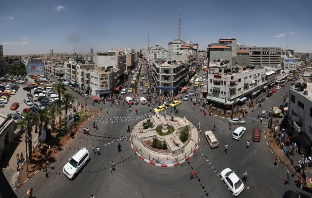
Omar Ibn al-Khattab Square
At a crossroads just inside Jaffa Gate, Omar Ibn al-Khattab Square is one of the most active places and also one of the most cosmopolitan, in the Old City. It is on the shortest route by foot between West Jerusalem and the Jewish Quarter (the Maghribi Quarter). At the northern end of the Armenian Quarter and the southern end of the Christian, the square is ideally located as a centre of activity and a passage to the Palestinian commercial heart of Jerusalem at Souk Khan ez-Zeit in the Old City and outside at Salah al-Din Street. The number of cafés, restaurants, hotels, and handicraft and souvenir shops equally make this a favourite destination for tourists.
The Citadel or David’s Tower (Qala’a Daoud)
At the highest point in Jerusalem, the tower was fortified under the Hasmonean dynasty in the second century BC. The present appearance of the citadel is due to work ordered by Mameluke Sultan al-Malik en-Nasser in 1310; the minaret and the mosque were built between 1635 and 1655. In 1967, Israeli occupation authorities closed the mosque and transformed it into the Museum of the History of Jerusalem; although the Israelis tailored history to fit their understanding of it, the museum is superb. A visit takes at least two good hours and a sharp eye to appreciate all the exhibits: the ruins include a Roman cistern and Umayyad walls; the collections include the replica of an Ottoman sabil and an impressive model of Jerusalem made by Hungarian artist Stefan Elias in 1873.
The Armenian Orthodox Patriarchate
Stretching from Jaffa Gate to Zion Gate is a huge complex, home to some of the Armenian community, its holy places and its institutions. The Armenian Church received the status of a patriarchate in the fifth century; its first known patriarch was named Abraham. In the mid-seventh century, the first patriarch received assurance from Caliph Omar Ibn al-Khattab of his full guarantee for the integrity, rights and privileges of the Armenian Church in Palestine. This protection is reiterated in a beautiful inscription in Arabic calligraphy engraved on the wall opposite the church’s main entrance.
To make a pilgrimage to Jerusalem has always conferred particular social prestige on pilgrims; those Armenians who visited the Holy Sepulchre and saw the tomb of Christ with their own eyes earned the honorary title “Mahdesi,” which signifies one who has seen death - referring to one who has seen the tomb of Christ.
Saint James’ Cathedral
Jewel of Jerusalem, Saint James Cathedral was built over the tombs of both the apostle and martyr, James the Wise, patron saint of Armenians, and of Saint James the “Pillar,” the brother of Jesus. Most of the main body of the building dates from the twelfth century, but the decorative elements were installed during the eighteenth century.
The Armenian complex is located opposite the cathedral (across the road). The buildings are private and include schools, a library, a seminary and a residential area.
❏ The Mardigian Museum
The museum, dedicated to Armenian history and culture in its entirety, is located in the ancient Armenian seminary. It has a very beautiful collection (cultural objects, manuscripts, costumes, robes and maps). Among the major pieces on display are the oldest books ever printed in Jerusalem (in 1833), and a picture of the Holy Sepulchre taken in 1861, when it was surrounded by open green space.
❏ Saint Mark’s Church
At the heart of the Syrian Orthodox or Jacobite community, Saint Mark’s Church is rich in evangelical tradition. The church is believed by the community to be where Jesus and His apostles celebrated The Last Supper and also where the Holy Spirit appeared to the apostles.
The Maghribi Quarter (The Jewish Quarter)
The Jewish Quarter in the Old City today exists as a result of the Israeli conquest of East Jerusalem in June 1967. The first action the Israelis took was to destroy the historical Maghribi Quarter (Moroccan Quarter), which dated from the reign of Afdal ed-Din, son of Saladin, between 1186 and 1196, and was completed in the Mameluke and Ottoman eras. The second Israeli decision was to expand and develop a new quarter. Since the time of Saladin there had been a small Jewish neighbourhood between the Armenian and Maghribi quarters. The people living here in the first half of the twentieth century were Orthodox Jews - both pious and poor - who depended on donations from Western Jewish communities (tzedaka). The community was divided into two ethno-religious groups with different cultures: Sephardi (in Hebrew, “from Spain”) Jews, who originally followed Spanish Rabbi Nahmanides here in 1267 (around the Meidan Road), and Ashkenazi Jews (Hassidic and Perushim) who immigrated here in the nineteenth century and organised around their own cultural centres.
During the 1948 war, the Arab Transjordanian Legion expelled the 1,500 Jewish residents of the Old City, along with the soldiers of the Hagana. In the first week following the occupation of the Old City in 1967, part of the historical quarter that dates back to the fourteenth century was demolished and more than 600 Palestinians were evicted to Shuafat Refugee Camp in N.E. Jerusalem. Two historically important mosques, al-Buraq and al-Afdaliya, were demolished. In April 1968, the area of the new Jewish Quarter was doubled by massive land expropriation and entirely replaced all the original population. Six thousand Muslim and Christian Palestinians were forced from 1,048 apartments; 437 workshops and shops employing 700 workers were also confiscated. All these people became refugees who, like all other refugees of 1967, are not included in UNRWA statistics. After cleansing the area of its inhabitants, the Israeli Labour Party undertook the judaising of the Old City. By destroying the historical quarter and replacing it with an artificial residential area, Israel obliterated all signs of the Arab heritage of the Moroccan Quarter. The quarter is now inhabited by wealthy Jews able to afford the extremely expensive apartments in this “Oriental style” neighbourhood, where the lingua franca is American English. Since 1981, a decision of the Israeli Supreme Court has formally prohibited the purchase of any property here by all non-Jews. The area is extremely clean and well kept, contrary to the situation elsewhere in surrounding Palestinian East Jerusalem, since the municipal services give special priority to appearance here and the comfort of its 2,000 Jewish inhabitants. Only the ancient ruins or places important in Jewish history are carefully indicated and explained to visitors.
Bab Harat al-Magharba (Maghribi Quarter Gate or The Dung Gate)
This gate was built in the sixteenth century and renovated by the Jordanian authorities after 1948 to make it possible for vehicles to pass through. It is known as the Dung Gate, in reference to a gate that was renovated under Nehemiah.
The Ophel Archaeological Garden![]() Located in the southwest corner of the Haram al-Sharif, at the entrance of the Maghribi Gate, this large archaeological park presents a historical panorama of Jerusalem.
Located in the southwest corner of the Haram al-Sharif, at the entrance of the Maghribi Gate, this large archaeological park presents a historical panorama of Jerusalem.
The Western Wall Tunnel
This tunnel under the Old City was opened to Israeli and foreign visitors in September 1996, authorised by Binyamin Netanyahu (in defiance of Israeli security warnings) as funded by American ultra-right billionaire, Irving Moskowitz. Its inauguration provoked violent reaction; Palestinians protested at Israeli lack of respect for Islamic holy places. The tunnel confirmed the continuation during the “peace process” of settlement expansion, including subterranean, and was seen as confirmation of Israeli claims to sovereignty over Occupied East Jerusalem. Today it is possible to walk under the Old City through tunnels that have been opened up by settler archaeologists, with a political agenda to connect the Muslim Quarter with the City of David and the Pools of Shiloah, as part of their agenda to “judaise” the subterranean region of the Old City. In an earthquake zone (the Afro-Syrian Rift), this is seen to be highly provocative and dangerous; but settlers who wish to rebuild the destroyed Second Temple have in the past been imprisoned by Israel for attempts to destroy the Al Aqsa Mosque, therefore undermining its foundations would not be such a far fetched figment of anyone’s imagination. Cartoons in Palestinian papers have shown the Al Aqsa Mosque sitting on a perilous cliff, with Israeli bulldozers busily excavating below it. Obviously, any damage to the mosque would be likely to ignite violence that might well spread throughout Palestine or even the wider Muslim world. No shortage of pyromaniacs in the settler community or even government; and no surprise that the current mayor of Jerusalem, Nir Barkat, cites the City of David as his favourite site in the city.
Hurva Arch
Hurva Arch is a contemporary twentieth century reconstruction of the original synagogue built by Ashkenazi Jews in the eighteenth century. Shortly after its construction, it was set on fire by its Jewish creditors, only to be rebuilt in 1864. However, it was destroyed for a second time by the 1948 shelling of the Maghribi Quarter.
Sidna Omar’s Mosque (Minaret)
Historical sources are specific about the minaret’s renovation in 1397, but nothing indicates the period of its construction. The muezzin’s balcony and the lantern are fifteenth century. Since the Maghribi Quarter’s destruction in 1967, worship in the mosque has been prohibited.
The Ramban Synagogue
In 1267, Andalusian Rabbi Nahmanides settled in Jerusalem, where he founded a community on Mount Zion near King David’s Tomb. In the fifteenth century, the Sephardi community moved and built a synagogue on the site of the present one. However, in the late sixteenth century the synagogue was transformed into a workshop; its original function was not restored until the Israeli occupation of the city in 1967.
Saint Mary of the Germans Church
The walls of the German Church of Saint Mary, which lie under the terrace of the ‘Quarter’ café, are all that remains of the mediaeval hospital complex. The hospice and the hospital met the needs of German-speaking pilgrims who spoke no French, the language of the Latin kingdom. Following the liberation of Jerusalem by Saladin, the German community founded the Teutonic Knights, a military order independent of the Hospitallers. They established their headquarters in Monfort Castle in Upper Galilee.
The Old Yishuv Museum
The museum derives its name from the term “old yishuv” (yishuv is the Hebrew word for “settlement”), as applied to the small Jewish community that lived in Jerusalem and throughout the country before the arrival of the first Zionist settlers in the 1880s. The museum occupies the former residence of a Jewish family, prominent members of the old yishuv, who lived here for five generations until the evacuation of the Jewish Quarter, after it fell in 1948.
The Mount of Olives
The so-called “Security Wall” has recently smashed its ugly, concrete way through this entire, ancient and historically resonant area, which is significantly less beautiful, even vandalised, as a result. Nevertheless, from the top of the Mount of Olives (Jabal ez-Zeitoun), there is a splendid view of the Old City with the Dome of the Rock and the eastern arid hillsides of Jerusalem in the foreground, and, on the horizon, the Jordanian Mountains. Since time immemorial, the Mount of Olives has been a holy place where one graveyard has succeeded another, until our present time. A place of mystery, the Mount of Olives is also associated with important moments in the life of Jesus. When Christianity was adopted as the state religion, in the sixth century, the mount was covered with no less than 24 churches.
The Mosque of the Ascension
Also known as the Chapel of the Ascension, this small octagonal sanctuary, originally surrounded by a covered colonnade, or portico, and a fortified monastery, was built by the Crusaders in the Middle Ages; it was then transformed into a mosque after Saladin’s victory in 1187, when the dome and mihrab were added. Islamic tradition holds that this was the place where Jesus, who is recognised by Muslims as a prophet, ascended into heaven. A footprint inside the sanctuary is said to be the last mark Jesus left on earth. Franciscan priests celebrate mass in this mosque three days every year: it is one of the rare places in the world where the two religions co-exist in harmony.
In a small crypt near the mosque is the tomb of a Bedouin woman, Rabia al-Badawiya, who died in the tenth century; despite the efforts of Ibn Battuta in the fourteenth century, her name was altered and eventually replaced by the name of a more celebrated female Muslim saint or mystic, Rabia al-Adawiya, who lived and died in Basra (in Iraq) in 801. Other traditions attribute the crypt to the prophetess Huldah (2 Kings 22:14-20) or as the burial place of Saint Pelagius.
The Russian Church of the Ascension
On the summit of the Mount of Olives, the tall square belfry of this convent stands out. Apart from a small museum and a fifth century Armenian mosaic pavement, discovered during construction work in the church between 1870 and 1887, one may enjoy the freshness and the fragrances of the delightful garden.
The Pater Noster Church
![]() This church and its Carmelite monastery were built by Princess de la Tour d’Auvergne, between 1868 and 1872. Archaeological digs in 1910 and 1911 revealed the ruins of the Byzantine church commissioned by Emperor Constantine, the Eleona Basilica or the Church of Olives, built over a grotto which tradition held was where Jesus ascended into heaven. At the end of the Byzantine period, the site of the Ascension was declared rather to be the summit of the Mount of Olives. Since then, the grotto has been associated with Jesus’ teaching of the Lord’s Prayer to his disciples, a tradition which was revived in the twentieth century. The tiled panels (in the cloister and outside it) display the “Lord’s Prayer” in over sixty languages.
This church and its Carmelite monastery were built by Princess de la Tour d’Auvergne, between 1868 and 1872. Archaeological digs in 1910 and 1911 revealed the ruins of the Byzantine church commissioned by Emperor Constantine, the Eleona Basilica or the Church of Olives, built over a grotto which tradition held was where Jesus ascended into heaven. At the end of the Byzantine period, the site of the Ascension was declared rather to be the summit of the Mount of Olives. Since then, the grotto has been associated with Jesus’ teaching of the Lord’s Prayer to his disciples, a tradition which was revived in the twentieth century. The tiled panels (in the cloister and outside it) display the “Lord’s Prayer” in over sixty languages.
Bethphage (or Beit Fage)
Bethphage is where Jesus started his triumphal entry into Jerusalem on Palm Sunday (Matthew![]() 21:1-17). The Bethphage Chapel inside the Franciscan monastery was built on ruins of a Crusader chapel, in the late nineteenth century. Notice the mediaeval paintings on the stone near the apse; this stone was thought to mark the place where Mary, Lazarus’ sister, first met Jesus. This has always been the point of departure, every Palm Sunday, of a procession commemorating the final entry of Christ into Jerusalem. The Wall is preventing access to Jerusalem from much of this area, El-Azaria (coming from the name Lazarus) or biblical Bethany, but the procession still follows this route as far as possible.
21:1-17). The Bethphage Chapel inside the Franciscan monastery was built on ruins of a Crusader chapel, in the late nineteenth century. Notice the mediaeval paintings on the stone near the apse; this stone was thought to mark the place where Mary, Lazarus’ sister, first met Jesus. This has always been the point of departure, every Palm Sunday, of a procession commemorating the final entry of Christ into Jerusalem. The Wall is preventing access to Jerusalem from much of this area, El-Azaria (coming from the name Lazarus) or biblical Bethany, but the procession still follows this route as far as possible.
The Tomb of the Prophets
A huge Jewish graveyard covers the southern slope of the Mount of Olives. It is Jewish religious practice to place a pebble on a grave every time one visits it. This rite ensures that the person buried there will be among the first to rise from the dead on the Day of Judgment. Indeed, all three monotheistic religions share the belief that the final judgment will take place around the Kidron Valley, at the foot of the Mount of Olives.
The Chapel of Dominus Flevit (“The Lord Wept”)
A tradition established by the pilgrims of the Middle Ages says that, as he neared Jerusalem on Palm Sunday, Jesus wept here over the future fate of Jerusalem (Luke 19:41), and therefore the chapel is called Dominus Flevit (The Lord Wept).
Church of Saint Mary Magdalene
![]() The church’s architectural and decorative style is typical of Moscovite religious monuments of the sixteenth and seventeenth centuries; with its seven golden cupolas, this church is one of the principal sights of the city of Jerusalem. It was consecrated in 1888 by the Grand Duke Sergei Alexandranovich (a brother of Tsar Alexander III) and the Grand Duchess Elizabeth Feodorovna. After the grand duchess was executed in 1917 during the Bolshevik Revolution, she was buried here, and to this day the church remains administered by the American White Russian community.
The church’s architectural and decorative style is typical of Moscovite religious monuments of the sixteenth and seventeenth centuries; with its seven golden cupolas, this church is one of the principal sights of the city of Jerusalem. It was consecrated in 1888 by the Grand Duke Sergei Alexandranovich (a brother of Tsar Alexander III) and the Grand Duchess Elizabeth Feodorovna. After the grand duchess was executed in 1917 during the Bolshevik Revolution, she was buried here, and to this day the church remains administered by the American White Russian community.
The Church of the Agony, Gethsemane - The Church of All Nations
This church consecrates the place, Gethsemane, where Jesus prayed the night before his arrest, and where He pronounced the painful words: “My soul is exceeding sorrowful unto death. Wait here and watch.”
In the Garden of Gethsemane the venerable and ancient olive trees with their gnarled trunks were witness (or, if not, must be descended from those original trees) to the desolation of Jesus, and his anguished prayers.
The Tomb of Mujir ed-Din
On the roadside above the Tomb of the Virgin Mary, there is a small tomb surrounded by a grille, the burial place of Jerusalemite historian and distinguished citizen, Mujir ed-Din al-Ulaymi (1456-1522). His writings are a precious source of historical information about a key period in the history of the city - the transition from the Mameluke state to the Ottoman Empire.
The Kidron Valley
The Kidron Valley, a countrified space at the gates of the Old City, also contains a number of burial sites. The upper part of the Kidron Valley has been identified as the Yehoshaphat Valley, where all men are supposed to be assembled on the Day of the Last Judgment; since ancient times, it has been the favourite burial place for Jerusalem residents.
Silwan and the City of David
Light years away from any archaeological interest in Palestinian antiquity, Silwan is one of the poorest and most densely populated areas in Jerusalem. Here, the discriminatory policy of the Israeli municipality is only too obvious. Infrastructure (roads, streetlights, pavements) - and public services (schools, garbage collection, and social services) are totally neglected. Since the early 1990s, the neighbourhood has also become a target for Jewish settlers, who today occupy many buildings. Court decisions at the end of interminable and costly legal procedures have in fact stipulated in the majority of cases that this occupation of Palestinian homes is against the law. These decisions have never been enforced, and now the area is under the effective control of the powerful settler organization ELAD (Hebrew acronym for The City of David). Under the protection of the Israeli police (especially the Border Police, a para-military force reporting directly to the Minister of Defence), settlers are continually entering and occupying new houses. These same settlers are the archaeologists digging both under the Old City and in the Silwan area. They are managing the Visitors’ Centre of Ir David (City of David) on behalf of the National Parks Authority, whereby they earn millions of dollars a year as entrance fee to various sites such as the Pools of Shiloah at the foot of the hill, and archaeological digs on behalf of the Israel Antiquities Authority. Their security guards have killed local Palestinians, and settlers in the area have also used weapons and wounded Palestinians, for example after a settler had hit a child, whose father then came to that settler to complain, on which he was shot in both legs and remains crippled. Settlers have taken over various properties in the whole area, either using a collaborator to buy those properties, or having the courts declare them abandoned properties, or by using false or forged documents. One resident tells of how his grandmother died, was laid out for the body to be washed, when a Palestinian collaborator arrived, and explained that he wanted to help the family to keep its property rights. He took fingerprints of the dead body, and the family was soon amazed to discover that their late grandmother had apparently sold the property, using those fingerprints as her signature! To this day that property has not been restored to its rightful owners.
Archaeological Garden of The City of David
On this modest acropolis, impressive ruins are visible today of the walls of the original thirteenth century BC Jebusite town: from the foundations of David’s fortress to the ruins which bear witness to the brutality of the Babylonian conquest of 586 BC, including the Burnt House. The steps leading down the hill, a hundred metres or so from the acropolis, lead to a vertical tunnel named after the English archaeologist who discovered it in the nineteenth century: Warren’s Shaft reaches a water basin fed by the Gihon Spring.
Mount Zion
The location of Mount Zion in the Old Testament corresponded to a hill east of Jerusalem. Today’s Mount Zion, however, is a hillsouth of the Old City, originally identified in the fourth century AD. Easiest to reach through Zion Gate (Bab en-Nabi Daoud), the hill was successively included or excluded from the city proper according to the strategic interests of the governors of Jerusalem. Following the 1948 war, the neighbourhood of Nabi Daoud was annexed to West Jerusalem and became an Israeli military outpost.
The Dormition Abbey
The Dormition Abbey is an imposing church in neo-Roman style, inspired by the Palatine Chapel of Charlemagne at Aix-la-Chapelle; Christian tradition holds that it marks the place where Mary lived her last days in an “eternal sleep.”
The Room of the Last Supper and the Tomb of David, the Prophet
A building located to the south of the Dormition Abbey contains two highly symbolic holy places: the Coenaeculum or Room of the Last Supper, where Jesus celebrated the Last Supper with his disciples, and the Tomb of David. A Jewish memorial to the victims in the Second World War has also been built here - the Chamber of the Holocaust.
Nablus Road and Bab ez-Zahra Quarter
If the historical, spiritual, and tourist heart of Jerusalem is the Old City, the neighbourhoods around Damascus Gate and Herod’s Gate have been the active centre of the Palestinian part of the city since 1948: Salah ed-Din Street, Sultan Suleiman Street, ez-Zahra Street, Nablus Road and Musrara Square constitute the central area, outside the city walls, of commerce, shops, services, cultural centres and entertainment in East Jerusalem.
King Solomon’s Quarries or Zedekiah’s Cave
A gigantic network of underground galleries lies underneath the Old City between Damascus Gate and Herod’s Gate; there is no evidence that it was built by King Solomon, to whom many monumental works have been attributed, nor can it be traced to the reign of King Zedekiah, who is said to have escaped in 586 BC from the Babylonian conquerors through these same subterranean tunnels. Yet it is almost certain that large amounts of stone from these quarries supplied Herod’s intensive building programme. Whatever the case, this underground quarry provides a rare glimpse of antique methods of stone excavation.
The Garden Tomb
The tomb was discovered in 1867 by Dr. Conrad Schick, whose name was given to the path leading to the tomb. Then, in 1983, General Charles Gordon, the British commander and conquering coloniser of China and the Sudan, identified the site as the “authentic” tomb of Christ. He argued that the hill behind the tomb looked like a skull. The Anglican bishopric supported this identification of the place, happy to revenge its exclusion from the Church of the Holy Sepulchre, where it had no rights, by creating its own Golgotha. Not all Anglicans, however, agreed that this was the true site. Gordon’s Tomb came to be known as The Tomb of the Garden (Garden’s Tomb), perhaps due to a mistake in transcription, and is today owned and administered by the The Garden Tomb (Jerusalem) Association, a Christian non-denominational charitable trust based in the United Kingdom.
❏ Saint George’s Cathedral
![]() Built in 1890, this cathedral is the seat of the Anglican archdiocese. Its neo-Gothic architecture, inspired by the colleges of Oxford and Cambridge universities, makes it one of the most distinctive monuments in Jerusalem. The complex houses a school, a seminary, a small garden, and two guest houses.
Built in 1890, this cathedral is the seat of the Anglican archdiocese. Its neo-Gothic architecture, inspired by the colleges of Oxford and Cambridge universities, makes it one of the most distinctive monuments in Jerusalem. The complex houses a school, a seminary, a small garden, and two guest houses.
The Tombs of the Kings
![]() Orientalists who visited the country in recent centuries considered this royal burial site the “eighth wonder of the world,” because of its spectacular first century AD royal sepulchre; they concluded that the Old Testament kings were buried here. It is indeed a complex of royal tombs, but more recent investigation has proved that this is the family vault of Queen Helena of Adiabene, an exile from her native Armenian kingdom, who converted to Judaism on a pilgrimage to Jerusalem.
Orientalists who visited the country in recent centuries considered this royal burial site the “eighth wonder of the world,” because of its spectacular first century AD royal sepulchre; they concluded that the Old Testament kings were buried here. It is indeed a complex of royal tombs, but more recent investigation has proved that this is the family vault of Queen Helena of Adiabene, an exile from her native Armenian kingdom, who converted to Judaism on a pilgrimage to Jerusalem.
The Museum of Arab Palestinian Folklore (Dar at-Tifl)
Although this museum of popular Palestinian tradition is not strictly professional, it is one of the best museums of its kind today. Its collection of Palestinian costumes and robes as well as its reconstruction of different handicraft techniques and scenes from traditional daily life in the first half of the twentieth century are the main attractions of the museum.
Orient House
This huge private house, built in 1897 by Ismail Musa al-Husseini, has a long diplomatic history. A year after its construction, it hosted Kaiser Wilhelm II of Germany (Kaiser Bill) for a tea party. The Ethiopian Emperor Haile Selassie lived here with his court from 1936 to 1937, during the Italian conquest. In 1949-1950, it became the temporary headquarters of the UN and UNRWA before being converted in 1967 into a hotel known as The New Orient House. In 1983, Faisal al-Husseini made it the office of the Arab Studies Society. Although Israeli authorities closed it from 1988 to 1992, it remained the official seat of the Palestinian political institutions in Jerusalem until the Israelis again closed it, in 2001, since when the Palestinians of East Jerusalem have not been allowed to operate any Palestinian institutions in the city, thus forcing those institutions to operate from Ramallah. The World Health Organisation now has its office at the Orient House.
The Palestine Archaeological Museum (Rockefeller Museum)
Founded in 1927 by an American-Jewish oil magnate, the museum was called the Palestine Archaeological Museum until 1967; it contains archaeological treasures from Palestine and the entire Near East, dating from prehistoric time until the eighteenth century. Amongst the masterpieces in the museum’s collection is a sculptured lintel from the Church of the Holy Sepulchre (Crusader period), carved wooden panels from the al-Aqsa Mosque (ninth century), stuccoes from the Umayyad Palace of Hisham in Jericho (eighth century), and some fragments of the Dead Sea Scrolls: the remainder having been transferred to the Israel Museum after the occupation of East Jerusalem in 1967. Going further back in time, the museum also has on exhibit a skeleton of ancient man (homo carmeliensis), dated 100,000 BC, which was discovered near Atlit, on the coast near Caesarea.
Wadi al-Joz Neighbourhood (Walnut Valley) At the end of the nineteenth century, the upper class of Jerusalemites lived near Herod’s Gate (Bab ez-Zahra). Their sumptuous mansions were conspicuous in the lands farmed by peasant day-labourers, or market gardeners, from nearby villages. Under the British Mandate, the valley became an urban area, whose population rose drastically with the influx of refugees fleeing West Jerusalem in 1948 and then the exodus from the rural areas, from 1950 to 1960. The inhabitants’ different origins explain the social and architectural diversity of the neighbourhood. In the late sixties, the last Palestinian mayor of Jerusalem, Rawhi Khatib, abandoned an urban renewal project intended to upgrade the area and to provide it with a bus terminal. Instead, he established an industrial zone, much of it on land his family owned here, in a lucrative “deal” for them; today this industrial zone specialises in motor mechanics’ workshops. In the 1980s, a 400-year-old, fortified agricultural building (qasr), whose owner was planning to transform it into an agricultural museum, was demolished by the Israeli authorities. It was condemned as illegal! The majority of recent buildings are also illegal: the slopes between Wadi al-Joz and the Hebrew University on Mount Scopus (built on land confiscated from owners in Wadi al-Joz at the time of the British Mandate) are officially classified “open green space” or “state land.” On the other hand, housing projects for the exclusive use of the Jewish population are being given the green light from the Israeli authorities. This explains why the Municipality of Jerusalem (pressured by the Jewish-run Hyatt Regency Hotel) has forbidden the construction of a girls’ secondary school for 800 students, on the pretext that the school would develop into a “point of confrontation.” A second project for a centre for 200 handicapped people was then submitted and rejected for “security reasons.” An Israeli parliamentarian, Yigal Bibi, argued: “…the youngsters may be handicapped, but that doesn’t mean that they have no arms to throw stones.” Indeed, in 2007 a Wadi Joz centre for handicapped children, the only one in that whole region of East Jerusalem, was demolished by the Jerusalem Municipality. Currently, there are at least 1,500 classrooms short in East Jerusalem, so classes are often overcrowded, with 40 pupils per class, and sometimes it is necessary to have one set of pupils at school in the morning, and another in the afternoon.
![]() West Jerusalem
West Jerusalem
West Jerusalem and East Jerusalem came into existence as a result of the partition of the city, in 1948. The Zionist conquest of the western part of the city in 1948 imposed a division de facto on the national character of Jerusalem, a city that had already been divided in many ways on previous occasions by various criteria: ethno-religious, familial, professional, social and so on. Mixed quarters of the city (Jaffa Road, Musrara, Shamma, Romema) sprang up between 1920 and 1940. However, the implementation of the Zionist and colonial ideology by most Jewish immigrants, combined with the fact that few of them spoke Arabic, reinforced the divisions between Palestinian Arabs and Jews. If ethnic diversity exists today in West Jerusalem, it is exclusively within the Jewish population itself. With the policy of ethnic cleansing practiced by Israeli forces in 1948, all Palestinians were driven out of the new part of the city. There, on the western side of the new city, about 10,000 Palestinian homes were totally ransacked between March and June, 1948. Although the names of the streets and neighbourhoods have been replaced, the Palestinian architectural heritage is still visible, in spite of the growth of this western part of Jerusalem. These days, there is even heavy Israeli property speculation involving “Arab” homes, and the term “Arab house” or “original Arab architecture” is given as an added incentive for the sale, or for the location.
Palestinian Neighbourhoods
The neighbourhood of al-Musrara
To the west of Damascus Gate, the al-Musrara Square neighbourhood was one of the first to be built outside the city walls by the extended well-established Muslim families of Jerusalem. In 1948, it was partly destroyed (Musrara Square and the main road, or Highway No. 1), then divided. The most beautiful residences became part of West Jerusalem in 1948 and are today in one of the most expensive Jewish areas in Jerusalem - known as Morasha in Hebrew or Musrara, its original name. On the other side of the main highway, which was a “no man’s land” from 1948 to 1967, there is a popular Palestinian market area that extends to Damascus Gate.
Mamilla
Mamilla is a deformation of the Arabic name “Ma’miat Allah” (God’s Sanctuary). Under the British Mandate, the area was the commercial centre of the new city, incorporating government and private administrative offices, the municipality, banks, shops, cinemas and cafes. The population was mixed here, and the architecture was inspired by contemporary European urban styles. A good example of this tendency is the old Palace Hotel, at the crossroads of Julian and Mamilla Roads, which is now being transformed into a new hotel (Waldorf-Astoria), with the interior totally gutted, but the façade preserved and renovated. The Post Office on Jaffa Road (still in service) was built by the mandatory authorities, on property given to them by the Armenian Patriarchate.
The YMCA A mixture of oriental Byzantine, Roman, Islamic, and Art Deco styles, this sumptuous and imposing complex was built between 1926 and 1933; it was the work of the American architect Arthur Loomis Harmon, equally celebrated for having built the Empire State building in New York City. There is a magnificent view of the city from the tower, which rises to 90 metres.
Birket es-Sultan (Sultan’s Pool) Sultan’s Pool was built by Sultan ez-Zaher Barquq in 1399 and was renovated in the sixteenth century by Ottoman Sultan Suleiman the Magnificent (1520-1566). It is now an Israeli open-air theatre, and a new park, named after the late Mayor of Jerusalem, Teddy Kollek. The Sultan’s Sabil, a fountain to the south of the pool (half buried under the present street) is precisely dated June 29, 1536. Note in particular its arch, pointed with chevrons (V-shaped mouldings) typical of that period.
Abu Tor Neighbourhood
A soldier in Saladin’s army, Sheikh Ahmad al-Tori, gave his name to this hill where he was buried, as well as to the village here. As the Jerusalem elite settled here in the nineteenth century, the village grew in two directions: small village houses spread out on the eastern foothills, while huge middle-class villas were built along planned roads which led to the Bethlehem Road and the railway station. The suburb was considerably developed in the 1930s. In 1948, the western part was occupied and renamed Givat Hanania, while the eastern part was annexed to East Jerusalem, under Jordanian administration.
South of Abu Tor, a sparsely-inhabited plateau is the site of the United Nations general headquarters. Until 1967, this hilltop was a huge “no man’s land.” A recreation area here, the Haas Promenade (Daniel Yanovsky Street) offers a splendid panorama of Jerusalem and the Old City. The Israeli government has instructed all official, licensed tour guides to show tourists the Wall (deceptively called the “Jerusalem Envelope”), which is being built in East Jerusalem, and which is so dramatic on the horizon that it cannot be ignored. Rather than take groups of tourists to the actual 9m high Wall, they take them to this lookout point, from where it can be seen in the distance, suitably remote so that tourists need not be involved in the huge human suffering it is causing.
The Talbiya neighbourhood
South of the YMCA, Talbiya (in Hebrew, Komemiyut, or uprising) is a neighbourhood of extremely beautiful, large Arabic villas built in the 1920s and 1930s. Development here started as a protest against the Greek Orthodox Patriarchate’s sale of a parcel of land to a Zionist organisation which then established the Rehavia area. As a result, wealthy Christian Palestinians of Jerusalem, Bethlehem, Beit Jala, and Ramallah built the Talbiya quarter. The majority of villas were built between 1924 and 1937. Several different schools of architecture influenced their design, especially the International Style of the 1920s and 30s. The stone, which was quarried and then worked by stonemasons in the area around Jerusalem, blends harmoniously with the Art Deco-style wrought-iron gates and railings which ornament most of the houses.
Talbiya’s charm and luxury have attracted many foreign diplomats, especially among the British. Among the most impressive residences is the Villa of Constantine Salameh (Orde Wingate Square). This villa was the Belgian Consulate after 1948. A wealthy businessman, Constantine Salameh (1897-1999) commissioned French architect Marcel Favier, who specialised in building public buildings and national palaces. In a totally different style is the Villa of Haroun er-Rashid
The Museum of Islamic Art
This museum has a very beautiful collection of objects including ceramics, miniatures, glass, calligraphy, jewellery and textiles, mostly from the seventeenth and eighteenth centuries, provenance of the entire Islamic world ... except for Palestine.
Al-Moscobiya (Russian Compound)
Built on a tract of land purchased by Tsar Alexander II between 1857 and 1858, the Russian Compound represents an excellent example of the inseparability of politics and religion. The complex has housed the Russian Consulate and the Russian Orthodox bishop’s palace since 1860. The cathedral distinguished by its green dome, the hospital, and the religious and educational institutions attached to the compound, received thousands of Russian pilgrims every year. After the inauguration of the British Mandate in 1917, most of the complex became the general headquarters of the British administration. In 1967, the Israeli authorities converted it into a police station better known as al-Moscobiya. Two steps away from the bustling cafes of West Jerusalem, the centre became a centre of “interrogation,” where all Palestinians from Jerusalem were taken when arrested. However, in 2004 a Border Police and General Security Services (Shin Bet) base named Metzudat Adumim (the “red fortress”) was built in Anata, next to East Jerusalem, to replace al-Moscobiya; it has been erected on a hilltop near Ma’ale Adumim on a piece of land called E-1 which was illegally annexed by Israel during the Oslo process and which has become highly controversial, due to Israeli plans to develop it and thereby thwart the “two state solution.” Such plans were revived in November 2012, when the UN General Assembly voted to recognise Palestine with observer state. Prime Minister Benjamin Netanyahu instantly responded by declaring that Israel would develop E-1 as a top priority, the plans having been frozen in 2005, under British pressure.
Nahon Museum of Italian Judaica
This elegant nineteenth-century building, built by German missionaries, shows the influence of Arabo-Islamic architecture. Today a museum of Jewish Italian art, it holds a famous collection of ceremonial art. The centrepiece of the museum is the synagogue of Conegliano Veneto, built in 1701 and transported to Jerusalem in 1952 from its original location in a town 35 miles from Venice. The synagogue functions as a place of worship for Jerusalem’s Italian Jewish community.
The Greek Colony
The area was originally built by the Greek Orthodox Patriarchate, for the benefit of Greek Orthodox Palestinian families and the Greek families who accompanied the exclusively Greek clergy. The first houses were built along Eftimos Street (today Yehoshua Bin Nun Street), named after Archimandrite Eftimos (who established this neighbourhood in 1902). At the time of the British Mandate, Palestinian Christians of various orders, Muslims, Greeks and British officials settled here; during the 1948 war, only international expatriates, safeguarded by consular protection, dared to stay in their homes.
The German Colony
![]() This neighbourhood was established in about 1860 by a German millenarist sect from Wurtemberg whose goal was “to create the ideal Christian community in the Holy Land.” By the end of the nineteenth century, over 40 families lived here; because the colony was near the railway station, some of its inhabitants specialised in railway freight transport between Jerusalem, Bethlehem and Jaffa. The houses were of a relatively modest design, but each had a garden, which to this day gives the German Colony a rural charm. Many of them are currently undergoing renovation, restoring them to their original state; there is also a cemetery in the colony where those German templars were buried. The Templars were Nazi sympathisers, and therefore the British sent them as prisoners of war to Australia during WWII; afterwards, when they had been returned to post-war Germany, they received compensation for their lost properties, which was deducted from the restitution paid by the German State to Israel and its holocaust survivors.
This neighbourhood was established in about 1860 by a German millenarist sect from Wurtemberg whose goal was “to create the ideal Christian community in the Holy Land.” By the end of the nineteenth century, over 40 families lived here; because the colony was near the railway station, some of its inhabitants specialised in railway freight transport between Jerusalem, Bethlehem and Jaffa. The houses were of a relatively modest design, but each had a garden, which to this day gives the German Colony a rural charm. Many of them are currently undergoing renovation, restoring them to their original state; there is also a cemetery in the colony where those German templars were buried. The Templars were Nazi sympathisers, and therefore the British sent them as prisoners of war to Australia during WWII; afterwards, when they had been returned to post-war Germany, they received compensation for their lost properties, which was deducted from the restitution paid by the German State to Israel and its holocaust survivors.
To the West of Jerusalem
The Monastery of the Cross
Hemmed in between motorways and scrublands where gazelles may still be found, this fortified mediaeval monastery is most unusual. Built by King Bagrat of Georgia in the eleventh century, the monastery rests on the place where a tree was cut down to make the cross on which Jesus was crucified. The Georgian Christian community was relatively important during the Mameluke period because of the good diplomatic relations at that time between the Mameluke state and the Georgian kingdom. However, in 1685, during the Ottoman period, the community declined in number and was forced to sell its monastery to the thriving Greek Orthodox church. The interior decor and the frescoes are remarkable; observe in particular the presence of Christian saints next to Greek philosophers and ancient pagan gods.
The Bible Lands Museum ![]() The unique objects in this museum are the provenance of a private collector of Polish origin, who in the course of his career succeeded in discovering the most rare objects. The Bible Lands Museum is not intended only to teach; the museum is, above all, an exhibition of unique pieces belonging to the ancient civilisations of the Near East and the Middle East. Most, if not all, of the ancient systems of writing are represented here, from the first signs inscribed on clay tablets to complete alphabets.
The unique objects in this museum are the provenance of a private collector of Polish origin, who in the course of his career succeeded in discovering the most rare objects. The Bible Lands Museum is not intended only to teach; the museum is, above all, an exhibition of unique pieces belonging to the ancient civilisations of the Near East and the Middle East. Most, if not all, of the ancient systems of writing are represented here, from the first signs inscribed on clay tablets to complete alphabets.
Some Palestinian Villages West of Jerusalem
Qastal
Because of its key position on the main route between Jaffa and Jerusalem, Qastal was the “key to Jerusalem.” For this reason, this small village of 90 people was stormed by the Hagana on April 3, 1948. The barbed wires and ditches are still visible. The Palestinian resistance managed to recapture it on April 8th. Villagers from the area were also on the battlefield, but as unarmed spectators they were limited in helping the combat, which certainly had some effect on the Zionist soldiers.
Abu Ghosh
The village of Abu Ghosh is the only Palestinian village to the west of Jerusalem whose population was not ethnically cleansed. On the route that links the coastal plain to Jerusalem, for centuries the village has been a halt for travellers, pilgrims and merchants. The ruins of an Abbassid caravanserai and reservoir (ninth century), renovated in the Mameluke period, are a short distance from the monastery there. Until the second half of the nineteenth century, the Abu Ghosh tribe collected a toll from all travellers entering their territory, which provoked outraged complaints to the Ottoman authorities from pilgrims and foreign diplomats. The Ottoman rulers, however, were mainly interested in discouraging the ambition of the tribal chiefs to establish a semi-independent state in their territory and start an open rebellion against the Ottoman central power.
The Crusader Church ![]() In the heart of the village, the church is Abu Ghosh’s main attraction. At the top of the village, Mount (or Jabal) Deir al-Azhar is crowned by the Church of Notre Dame of the Ark of the Covenant, on which stands a monumental statue of the Virgin and Child. The church was built over a Byzantine church, which in turn was erected over an Iron Age village. The Byzantine church’s mosaic pavement is still preserved. The village is thought to be Qiryat Yearim (which name has now been used by a new, ultra-Orthodox neighbourhood next door to Abu Ghosh), where biblical tradition says the Philistines gave the Ark of the Lord back to the Israelites.
In the heart of the village, the church is Abu Ghosh’s main attraction. At the top of the village, Mount (or Jabal) Deir al-Azhar is crowned by the Church of Notre Dame of the Ark of the Covenant, on which stands a monumental statue of the Virgin and Child. The church was built over a Byzantine church, which in turn was erected over an Iron Age village. The Byzantine church’s mosaic pavement is still preserved. The village is thought to be Qiryat Yearim (which name has now been used by a new, ultra-Orthodox neighbourhood next door to Abu Ghosh), where biblical tradition says the Philistines gave the Ark of the Lord back to the Israelites.
Malha
The origins of this village are lost in the mists of time. In the sixteenth century, it was called Maliha es-Sughra and had 300 inhabitants. Under the British Mandate, the village soon became a suburb of Jerusalem. On the night it was attacked, it had a population of 1,940 (1,930 Muslims and 10 Christians).
Ein Karem
Ein Karem (the spring of the vineyard) was the birthplace of St. John the Baptist or Nabi Yahya (the Prophet John the Baptist), according to Christian tradition. Ein Karem grew considerably in the late nineteenth century; although the majority of the population was Muslim, various Christian communities (the Franciscans, the Sisters of Zion and the Russian Orthodox) built monasteries and convents in the village and its vicinity.
Protected by mountains and forests, Ein Karem was an important stronghold of Palestinian resistance; it was even freed of British occupation at one point. In 1945, the village had become a suburb of Jerusalem and the population had risen to 3,180 inhabitants - (2,510 Muslims and 670 Christians). Many of its inhabitants were prosperous businessmen or craftsmen.
The Village Today
Despite its integration into the Jerusalem municipality, Ein Karem has preserved its rural charm. Its traditional architecture indicates its unequivocal prosperity, which is in part due to the many religious foundations here, and its proximity to Jerusalem. It is hardly surprising that before 1948 the village had been given the honorary title “capital of the villages.” Today, the temptation of its Jewish residents to change its identity is above all perceptible in the sight of Israeli emblems placed over the antique buildings’ entrances. Some wealthy residents have even had their houses built on traditional Palestinian architectural lines, integrating their own national-religious symbols into them. The numerous cafes and restaurants of Ein Karem are highly appreciated by West Jerusalemites, especially in the evenings and at weekends. A visit to Ein Karem during the week is even calmer. Surrounded by wooded hills, it is also a perfect place for invigorating walks to one’s heart’s content. A hiker may plan a full day out on the marked paths. It is also the site of annual concerts of ecclesiastical music in the various churches.
For a shorter walk, follow the path that starts at the Mosque of Omar. Below the mosque runs Mary’s Spring which, according to tradition, gushed up when Mary appeared to Elisabeth.
![]() Church of St. John the Baptist
Church of St. John the Baptist
This church was built in 1674 on the site said to be where the house of Zacharias and Elisabeth (parents of St. John the Baptist) stood. The remains of a mosaic pavement from an old Byzantine church can be seen through an iron railing below the porch; an inscription in Greek on the pavement says: “Salvation for God’s Martyrs.” Inside the church, there are several darkish paintings from the seventeenth century; above the altar, the painting of The Visitation is attributed to the celebrated Spanish artist, El Greco (1541-1614). To the left of the altar, there are stairs leading down into a natural cave called the Grotto of the Nativity of St. John the Baptist.
The Church of the Visitation
This is a recent church, built in 1955; it commemorates Mary’s visit to her cousin Elisabeth.. Inside the chapel, a mark (to the right of the entrance) is said to have been made by the footprint of the infant St. John the Baptist. According to pre-Byzantine legend, Elisabeth escaped to a hill to hide her child after learning that Herod was looking for all children under two years of age. Having found no place, she invoked “the mountain of God” which opened and offered them refuge.
To the East of Jerusalem
Shu’fat Refugee Camp
This refugee camp was built in 1965 and 1966, more than ten years after other officially recognised camps, for refugees living in extremely bad sanitary conditions in the Mu’ascar Camp in the Maghribi Quarter in the middle of the Old City. Mu’ascar Camp was closed, after the establishment of the camp in Shu’fat. After the occupation of 1967, Shu’fat was the only refugee camp included in the borders of the Municipality of Jerusalem. The official number of refugees is around 10,000, but the actual number of residents is over 15,000. People pay no land taxes here, and water is free, factors which attract the poorest of Jerusalem to live here, as well as the fact that land available for construction in Jerusalem is so rare that housing prices there are exorbitant. In addition, other refugees or non-refugees who had their homes outside the municipal boundaries of Jerusalem returned here in order to keep their Jerusalem residency card, since Shu’fat is inside the city boundaries. Therefore, residents have no choice but to construct both in an extremely cramped way, and also only upwards (3 to 4 storeys). Building foundations are dangerously fragile, and there are no security norms. People often try to extend the area of the camp even when threatened with demolition; for instance, on July 9, 2001, 17 houses were destroyed by Israeli authorities, after demolition orders were issued only the night before. On many occasions, the municipality hears of new houses being built from residents of the neighbouring Pisgat Ze’ev settlement, illegally built during the Oslo Peace Process on the opposite hill, who complain that the building reduces the value of their property (a visit is recommended: Third World vs. First). To make matters worse, the route of the Apartheid Wall runs around the edge of the Shu’fat Refugee Camp, excluding its residents from easy access to Jerusalem despite their residency status (not full citizenship) and trapping them in a ghetto with only one exit, a huge five-lane military checkpoint (or ‘Crossing Terminal’, in the lexicon of the occupation). The Wall has been built hermetically around the camp and Anata, preventing free access into Jerusalem except through the checkpoint. Many of the Palestinian East Jerusalem neighbourhoods have been ghettoized in this way: Shu’fat, Anata, Azariya, Abu Dis, al-Jib, Bir Nabala, Al Walaja, Al Nu’man, Sheikh Saad, A- Ram – all in the name of ‘security.’ Curiously, when the Mayor of Jerusalem, Nir Barkat, announced that the Shu’fat Refugee Camp and Anata would be considered outside the municipal boundary of Jerusalem, it was right-wing settlers who objected, asking who he was to sacrifice Jerusalem land to the Palestinians.
Anata - An Ordinary Village
![]() Originally an agricultural village, today this suburb of Jerusalem has 12,000 residents. Since the 1967 occupation, the village and its lands have been divided. Today, only a third of the population belong to the municipality of Jerusalem; the other two-thirds are in Area B or Area C. According to Israeli regulations, people in the West Bank’s Area C do not have the right to go to the other part of the village without an official permit, which is extremely difficult to obtain. Since 1967, almost two-thirds of the village’s lands have been confiscated. Five Jewish settlements have been built on part of them: Alon, Nofei Prat, Kfar Adumim, Almon (Anatot) and Ma’ale Adumim. Whilst Anata suffers from lack of infrastructure, a new Israeli prison has been built there, on land illegally annexed during the Oslo “Peace Process.” Ma’ale Adumim, on Anata and Azariya land, currently has a population of 40,000 settlers; building proceeds rapidly there.
Originally an agricultural village, today this suburb of Jerusalem has 12,000 residents. Since the 1967 occupation, the village and its lands have been divided. Today, only a third of the population belong to the municipality of Jerusalem; the other two-thirds are in Area B or Area C. According to Israeli regulations, people in the West Bank’s Area C do not have the right to go to the other part of the village without an official permit, which is extremely difficult to obtain. Since 1967, almost two-thirds of the village’s lands have been confiscated. Five Jewish settlements have been built on part of them: Alon, Nofei Prat, Kfar Adumim, Almon (Anatot) and Ma’ale Adumim. Whilst Anata suffers from lack of infrastructure, a new Israeli prison has been built there, on land illegally annexed during the Oslo “Peace Process.” Ma’ale Adumim, on Anata and Azariya land, currently has a population of 40,000 settlers; building proceeds rapidly there.
Al-Azariya (Bethany)
The Arab name of the town originates from the Greek “Lazarion,” or “place of Lazarus,” as Bethany was known during the Byzantine period. Evangelical tradition has it that it was here that Jesus raised his friend Lazarus from the dead (John 11). This same tradition is shared with Muslim residents of al-Azariya, where the al-Ozir Mosque honours Ozir, who is thought to have been the brother of Lazarus. The two churches next to the mosque commemorate the resurrection of Lazarus. The Franciscan Church of the Province or Saint Lazarus Church, consecrated in 1954, is the work of the ubiquitous architect Antonio Barluzzi. Designed without any windows, the church is definitely unique. In fact, Barluzzi wanted to contrast the semi-darkness, symbolic of Lazarus’s death, with the hope of resurrection, symbolised by the opening in the dome, the unique source of light. On the walls are impressive mosaic panels representing the different scenes of Jesus’ visit to Bethany. Outside the church are the remains of mosaic pavements with geometrical motifs which belonged to a Byzantine church of the fourth century.
Above the mosque, stairs lead to the Tomb of Lazarus, which consists of a vestibule and a burial chamber.
The Greek Orthodox Church of Saint Lazarus is further up the street. This church was built in 1965, but the interior was only recently completed. The iconostasis (screen with icons) created by Greek cabinet-makers, and the extremely beautiful modern icons, are of particular interest.
People to meet
Christian Information Centre is the best place for information on Christian holy places, times of different church services and the many Christian hospices which accept guests. (Omar Ibn al-Khattab Square near David’s Tower next to the Jaffa Gate).
Tourist information centres are located at the Jerusalem Municipality at 34 Jaffa Road and at 24 St. George’s Street.
The main post office in East Jerusalem is at the intersection of Salah ed-Din Street and Sultan Suleiman Street.
Al-Mamal Foundation for Contemporary Art Al-Mamal Foundation opened in 1997 with the aim of stimulating cultural life in East Jerusalem. Among its main activities, the centre organises photography workshops for young people; their work is regularly displayed there alongside photographs by professionals. Check their website for current events and exhibitions.
The Palestinian National Theatre (al-Hakawati - The Storyteller) Founded by the al-Hakawati theatrical company in 1984, this theatre is the cultural centre of Jerusalem. Programmes include pieces of theatre, concerts, films, shows for children and puppet show festivals. The Palestine Festival of Literature inaugurated its first season here, in 2008, but Israeli Border Police came to close down the opening event – which therefore decamped, together with its refreshments, to the nearby British Council garden. Similarly, the closing event was therefore held at the French Cultural Centre.
Alternative Tours In keeping with the philosophy of alternative or cultural tourism, this agency opts for realities of life in Palestine: history, sites, culture, society and the political situation.
The Community Development Centre- Nidal This centre was created in co-operation with the UHWC (Union of Health and Work Committees) to meet the need for social and medical programmes in the Old City, which has over 32,000 Palestinian residents. The centre holds many educational and cultural activities for children and adolescents to encourage equality between the two sexes, to stimulate learning and to instil progressive values.
The Centre for Jerusalem Studies - Al-Quds University The centre organises thematic tours on the architectural and cultural patrimony of Jerusalem. Tours are usually on Saturday from 10:00-13:00. Al-Quds University also offers courses in Arabic dialect and classical Arabic during the school year and intensive classes in the summer.
Alternative Information Centre (AIC)
The Palestinian General Federation of Trade Unions (PGFTU) Established in 1965, the Palestinian General Federation of Trade Unions is heir to the Trade Union Movement of Palestinian Workers (1925-1948). The federation today is an umbrella body for more than 10 sectors of employment - in public administration, construction work, teaching, media and publishing, the agro-food industry, the metallurgic industry, catering and tourism, among others. In 1999, the union had more than 80,000 members. A trade union has to conform to a complicated multiplicity of work legislation: Jordanian, Palestinian, and Israeli. The situation of Palestinian workers in the West Bank and the Gaza Strip who work inside Israel is difficult and it is almost impossible to defend their rights. Since the beginning of the al-Aqsa Intifada, Palestinian workers with work permits have lost all their rights including unemployment compensation, social security and retirement pensions. In litigation with Israeli or Jerusalemite employers, PGFTU cannot intervene directly because it is not officially recognised by the Israeli authorities. Its only resource is to give legal advice with the help of lawyers.
Sabeel (The Ecumenical Centre of Liberation Theology) The English equivalent of “Sabeel” is “the road” or also “a fountain.” Founded by Palestinian Christians, the centre has a vocation to share the daily life of Palestinians under occupation from a theological and a secular point of view. Sabeel organises frequent conferences, lectures, meetings and cultural evenings.
The Union of Palestinian Medical Relief Committees (UPMRC)
A non-government organisation, UPMRC was founded in 1979 to compensate for the lack of adequate structures for medical care in the Palestinian territories since their occupation twelve years previously, in 1967. The UPMRC offers medical services of all kinds and is particularly active in the field of preventative medicine. Since 1996, the society has initiated a first-aid programme, which has proved of great importance and efficiency since the beginning of the al-Aqsa Intifada.
Swedish Christian Study Centre
The study organisation, Bilda, enjoys longstanding contacts and exchange with Palestine. Since the 1960s, Bilda’s work in the Holy Land has focused on study trips, research projects, cultural exchange and dialogue between people, religions and cultures. Bilda’s permanent presence in the Holy Land, the Swedish Christian Study Centre (SCSC) was established in 1991. The Study Centre enables visitors from Sweden and other countries to research and study local cultures, religions, history and politics. One of the SCSC’s main aims is to promote and support the local people in Palestine and to provide an interface for people from Sweden and those of the Middle East. The meetings and discourse that ensue provide new understanding and insights which build bridges across cultural, religious, ethnic and political divides.
Places to Eat
Places to Sleep
Austrian Hospice (At the junction of al-Wad Street and Via Dolorosa, 02-626 5800 office@austrianhospice.com.Sgl, dbl or tpl. 48, 76 and 118. Bed in dormitory 18. The doors close at 22h, so ask for a key if you expect to come back late; bar, restaurant.) A real haven of calm in the heart of the Old City, this building was built in 1869 and was successively the Austrian Consulate, a convent and a hospital until the mid-1980s. Since then, it has been transformed into a hospice and a café-restaurant, with a charming patio and garden courtyard. The rooms are clean and comfortable. Spacious dormitories with new facilities are also available and are an attractive choice both for groups and individual travellers. The peaceful terraced garden, away from the noise of the street, is in itself worth a visit, as is the rooftop view over the Old City. The restaurant serves Austrian and other specialities.
Gloria Hotel (33 Latin Patriarchate Street. 02-628 2431. gloriahl@netvision.net.ilSgl, dbl and tpl $60, $100 and $150. bar, cafeteria.) The hotel is located on a busy street; evening is the busiest time. The rooms are clean and comfortable and much favoured by pilgrims. There is a panoramic view of the Old City from the rooftop.
Knight’s Palace (Latin Patriarchate Street; 02-628 2537 kp@actcom.co.ilSgl, dbl and tpl $65, $110 and $150, bar, restaurant.) This charming nineteenth-century building was once a seminary; the rooms were actually the former cells of young students studying for the priesthood. They have very high ceilings, and are elegant and comfortable; some family rooms have a mezzanine. In the restaurant, there are stone blocks that were part of the wall around Jerusalem in Roman times.
Hashemi Hotel & Hostel (73 Souk Khan ez- Zeit, Via Dolorosa 02-628 4410, fax: 02-628 4667, www.hashimihotel.com. Dormitory beds cost NIS19. Sgl, dbl and tpl 35, 55 and 65; cafeteria.)
Recently renovated, the hostel has real character, and the rooms are comfortable. The cafeteria and the common area on the roof have an absolutely splendid view of the Old City and the Dome of the Rock.
New Imperial Hotel (Omar Ibn al-Khattab Square. The entrance is to the left, up an alley, under the hotel’s sign: ring the bell. 02-628 2261 (imperial@palnet.com). Sgl, dbl and tpl $50, $75 and $100. cafeteria, @ and CB.) Built in 1884, the hotel is a little dilapidated, and its decoration is, to say the least, eclectic. It still has a definite charm. Ask for a room with a balcony looking onto Omar Ibn al-Khattab Square and the Citadel; some family rooms have a mezzanine. Every room has a toilet and shower en suite. Mr. Dajani, the owner, will gladly relate the current state of his ownership of the hotel, which is claimed in Court by rightwing militant settlers.
Hebron Hostel (8 Aqbat et-Taqiya, near the Ninth Station of the Cross on the Via Dolorosa. 02-628 1101. Bed in a dormitory NIS35. Double rooms with shower NIS130-150 and NIS110 without shower, bar, cafeteria, @ and a CB.) The rooms are clean and comfortable and there is an Internet café, (NIS 10 per hour). The arches and natural stone walls lend a special charm to the small, recently renovated dormitories. On the other hand, the large dormitory on the top floor is much more anonymous, with a lot of bunk beds almost on top of each other.
Ambassador Hotel (Sheikh Jarrah 02-5412222 amb@netvision.net.il.Sgl, dbl and tpl $135, $150 and $200, bar, cafeteria and CB.) The hotel is very comfortable and spacious, with a beautiful view. It has several common rooms (lounges, large verandah and gardens). It also has two excellent but somewhat expensive restaurants: Addiwan (Arab specialities) and Tent, a garden restaurant; there is also an excellent patisserie shop at the entrance to the hotel. The place is lively because it is frequently used for press conferences and meetings. Nevertheless, one can always find an island of calm amidst all the activities here.
American Colony Hotel (Nablus Road. 02-627 9777 reserv@amcol.co.il. $315 single and$390 to $780 double room. Bar, restaurant, gift shop, bookshop, swimming pool, sports centre and CB.) The principal house in the neighbourhood, it originally belonged to Selim al-Husseini, Mayor of Jerusalem (1882). In 1896, it was rented to a Swedish-American messianic group, led by Horacio Spafford; later, the house was purchased by Baron Ustinov, who transformed it into a hotel. This luxury hotel is the preferred rendezvous for diplomats and journalists; with its rooms, gardens and cafes, the American Colony offers outstanding comfort and atmosphere. Its cosmopolitan ambience, bridging the gulfs between Israel and Palestine, the Middle East and Europe or America, hints at how life in this troubled part of the world could have been different and yet still may be.
Az-Zahra Hotel (Az-Zahra Street. 02-6282447. azzahrahotel@shabaka.net.Sgl, dbl and tpl $75, $112 and $135 without breakfast, bar, restaurant and CB.) Originally a residence built at the beginning of the twentieth century, it has been a hotel since 1948. The neighbourhood is quiet; the rooms are simple but comfortable, and some have a large balcony. Its café and restaurant are popular with Jerusalemites, especially those seeking pizza. There are musical evenings every Thursday.
Golden Walls Hotel (Sultan Suleiman Street. Tel: 02-627 2416, info@goldenwalls.comSgl, dbl and tpl $120, $170 and $200, bar, cafeteria and CB.) This hotel overlooks the city walls. The decor of the rooms is classic, and those rooms are very comfortable: air conditioning, satellite TV, hair dryer and safe. The hotel also has a large restaurant and a bar.
Jerusalem Hotel (Nablus Road. 02-628 3282. raed@jrshotel.com. Sgl, dbl and tpl $130, $160 and $190. Free for children under six. Reservations essential. Bar, restaurant, CB.) The highly advantageous geographical location near Damascus Gate, the architecture and Kan Zaman café-restaurant (two rooms: one a somewhat smoke filled terrace where Nargilehs are popular, and one underground), its prices which are considerably less than for similar accommodation at the American Colony, make this hotel a favourite rendezvous. The oriental character of what was once a private home adds to the charm of your stay here. The rooms are spacious and the surroundings refined (Egyptian furniture and exposed stone walls); each room has a unique decor. Excellent service, and musical evenings every Friday.
Mount Scopus Hotel (Sheikh Jarrah. 02-582 8891, mountscopus@barak.net.il.Sgl, dbl and tpl $80, $100 and $150, bar, cafeteria and CB.) Comfortable, spacious rooms with large balconies and a superb view.
Notre Dame Hospice (Opposite New Gate. 02-627 9111 Fax 02-627 1995. Sgl, dbl and tpl $80, $110 and $159, bar and restaurant.) Owned by the Vatican, this large complex receives mainly pilgrims, but all guests are welcome. The rooms are simple with TV and air conditioning; there is also a terrace café (open 9:00 to 23:00) and a good (rather expensive) restaurant “La Rotisserie” as well as a newly opened 5th floor wine and cheese salon.
Saint George’s Cathedral Pilgrim Guest House (8 Salah ed-Din Street. 02-627 7232 sghostel@netvision.net.ilSgl, dbl and tpl $80, $120 and $160, bar and cafeteria.) The architectural setting and the garden more than compensate for the austere but clean rooms here. The bathrooms have recently been renovated.
Victoria Hotel (Massudi Street. 02-6274466, fax 02-627 4171. Sgl, dbl and tpl $60, $80 and $100, bar, cafeteria and CB.) The rooms are calm and both comfortable and well-equipped.
Mount of Olives
Mount of Olives Hotel (53 Mount of Olives Road, near the Mosque of the Ascension. 02-628 4877 info@mtolives.com Sgl, dbl and tpl $54, $78 and $110) Most of the clean, calm rooms have a superb panoramic view.
Seven Arches (Mount of Olives. 02-626 7777 svnarch@trendline.co.ilSgl, dbl and tpl $100, $130 and $150. The hotel has bar, restaurant, CB, and phones operated by cards purchased in the hotel.) This hotel offers a spectacular view of the Old City and Haram al-Sharif. Slightly old-fashioned, its large common rooms (lounges and corridor) are comfortable although they are so large -- the fashion in the 1960s when the hotel was built. The rooms are comfortable, very well- equipped and very well-lit, and some have been recently renovated. The Seven Arches Hotel also has a Parisian-style café-restaurant, the Bistrot, which serves excellent meat cooked on hot stones.
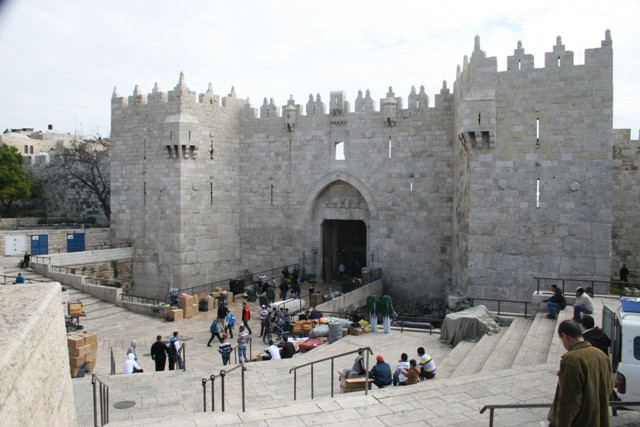
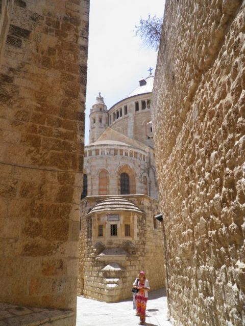
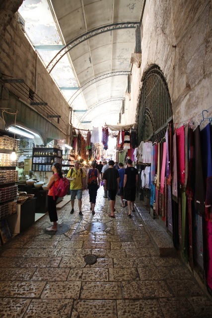
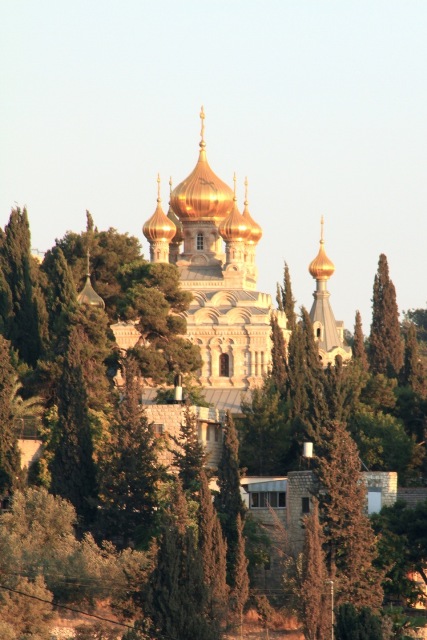
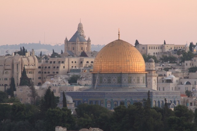
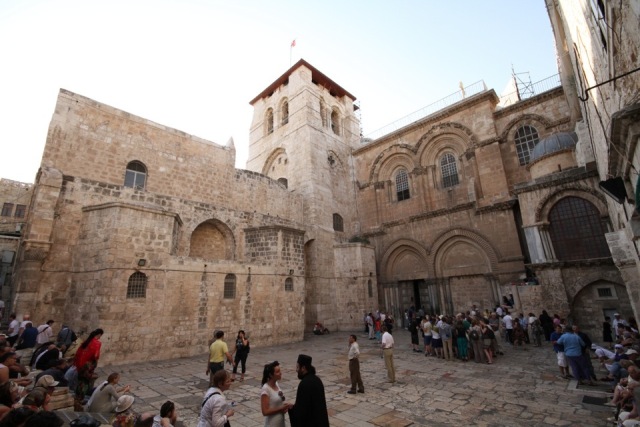
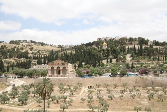
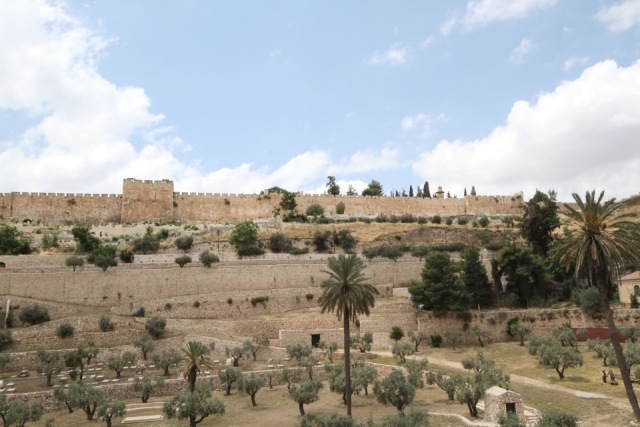
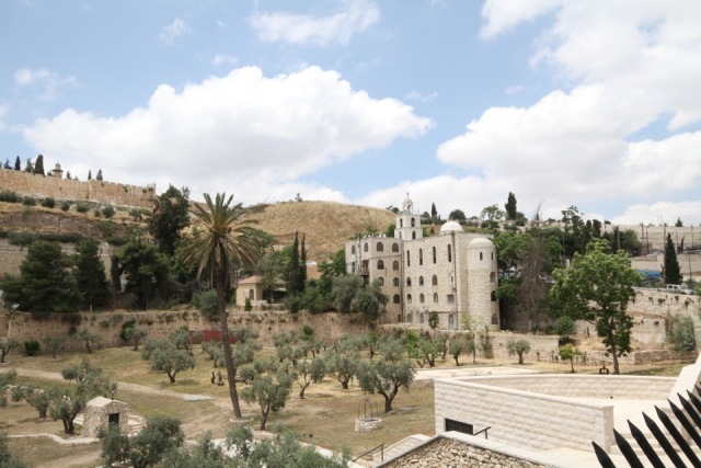
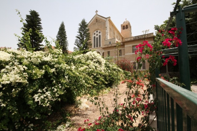
Background
Clinging to a rocky spur, Bethlehem dominates a vast hinterland, some of which is desert. To the east, arid hillsides plunge steeply into the Jordan Valley. In the distance, the high Jordanian plateau forms the horizon. Bethlehem constitutes, together with the towns of Beit Sahour (to the east) and Beit Jala (to the west) and the three refugee camps, Aida, Beit Jibrin (or ’Azza), and Deheisheh, an agglomeration of over 76,000 people. The Bethlehem district, encompassing the surrounding villages, numbers around 180,000 people. Dominated by bell towers and minarets, the city affirms its religious diversity: it has a Muslim majority of 65% and a strong Christian minority of 35%. The local economy is heavily dependent on tourism, which employs up to 20% of the working population. Since the Second Intifada, tourism has been badly scarred and the Wall and surrounding checkpoints imprison Bethlehem, Beit Sahour, and Beit Jala.
Things to see (in and around Bethlehem)
The Palestinian Heritage Centre (Ms. Maha Saca) is at the entry of Bethlehem, the centre has a small museum (one may try on traditional Palestinian clothing), and a gift shop with extremely beautiful embroidery work, among other products. www.phc.ps
The Old Bethlehem Museum is a museum dedicated to arts and popular traditions. It is located in a traditional house dating back to the seventeenth century. It has a beautiful collection of traditional embroidery and costumes; photographs of Palestine during the 1920s and 1930s complete the collection.
The Manger Square is a vast esplanade between the Mosque of Omar and the Church of the Nativity, which constitutes the tourist centre of Bethlehem. Many events throughout the year take place here, culminating on Christmas Eve. There are frequent cultural exhibitions, concerts, and conferences at the Bethlehem Peace Centre at the square. The tourism office and a bookshop which also sells souvenirs are on the ground floor of the peace centre.
The Basilica of the Nativity. The Church of the Nativity, and the religious buildings around it, form an imposingly austere monument. The basilica was consecrated in 326AD and subsequently underwent many substantial modifications. The Grotto of the Nativity is the Grotto where Jesus was born. The Church of the Nativity and the Pilgrimage Route (Star Street), have been selected by UNESCO as World Heritage Sites on June 29, 2012.
The Milk Grotto. It is said that the Holy Family stopped here on their way to Egypt so that Mary could nurse the baby Jesus. While he was nursing, a few drops of his mother’s milk fell on the ground and turned the red rock white. Ever since, women of both faiths have come here to pray, especially those with fertility problems or a shortage of milk during breastfeeding. It is customary for them to chip off a little piece of the chalky rock and swallow it after praying.
Al-Khader Church (Saint George’s): every year on May 5, there is a pilgrimage to the al-Khader Church. The pilgrimage takes place in honour of Saint George (in Arabic la-Khader), the soldier monk who slew the dragon and who is venerated for being able to ward off the evil eye. Islamic tradition states that he left his native Lydda, and settled in this village, which now carries his name. Muslims and Christians come together annually on this day to celebrate their common protector, to whom many different blessings are attributed.
Solomon’s Pools, near the top of a valley, form one of the main sights in the area. These three rectangular reservoirs are situated one above the other on a gentle slope. They were part of an ancient water supply system for the city of Jerusalem.
Wadi Artas is a fine example of the fertility of Palestinian valleys, its ideal landscape calling to mind the paradise lost that is said to have been King Solomon’s garden.
Tent of Nations is a project that seeks to bring youth of various cultures together to build bridges of understanding and reconciliation. The organisation invites both young people from the local community and international groups to work together on projects and activities at their vineyard.
An-Nu’man is a small village situated on the slopes of the hills between Jerusalem and Bethlehem. Its high and isolated position offers impressive views of the two cities and the surrounding landscape, interrupted only by the intrusive presence of the huge eyesore that is the Har Homa settlement, growing at an alarmingly cancerous rate, and the Separation Wall, which now encircles the village. Deprived of municipal services, the people of An-Nu’man must cross a checkpoint every day in order to access basic facilities and carry out daily tasks. They are allowed no visitors and must negotiate with the Israeli military all incoming supplied of food and water.
The Monastery of Saint Theodosius (Deir Ibn Ubeid) (5th century AD): the grotto under the monastery (built by Theodosius) is believed to have sheltered the three kings returning from their visit to Baby Jesus in Bethlehem. They had been warned in a dream not to visit Herod, but to take another way home.
Mar Saba Monastery (5th century AD): clinging to the face of a cliff, the Mar Saba Monastery looks out over the Kidron Valley. If it were not for its copper-covered domes and its white houses with their blue windows, it would be hard to tell the monastery from the steep walls of the cliff. The body of Saint Sabas, stolen by Venetians, but restituted by Pope Paul VI in 1965, lies in the second chapel of the main church, wrapped in a coat fringed with gold.
Herodion or Herodium (Jabal al-Furdeis) stands out against a background of arid hills and cultivated land like an artificial volcano and is undoubtedly the most impressive of all King Herod’s palace-fortresses. The Herodion itself is the greatest artistic achievement. A generous third of the earth and gravel was used to make an earth rampart, laid against the outer foundation of the fortification (62m in diameter), raising the hill and giving it its distinctive conical shape. This type of arrangement was unique to its time.
Institutions, Organisations, Centres & people to meet
Applied Research Institute of Jerusalem is a non-profit organisation. It promotes applied research, technology and skills trainings, sustainable development, and Palestinian self-sufficiency through greater control of their natural resources. www.arij.org
Bethlehem University was created to give all young people from the south of the West Bank, both Muslim and Christians, the opportunity to pursue higher education in their region, and to minimise Christian emigration; it has around 3,000 students and offers a wide choice of studies. By making it possible for young Palestinians to pursue higher education in Palestine, Bethlehem University proved to be an excellent means of holding back the emigration of qualified citizens. www.bethlehem.edu
Diyar International Centre of Bethlehem is a Lutheran organisation committed to community empowerment through training programmes, intercultural encounters, art and music workshops, and other activities. Its programmes are mainly aimed at women, children, youth, and the elderly, but are open to the whole community. The gift shop is worth a visit, as is the Al-Kahf Gallery that has frequent exhibitions. www.diyar.ps
The Ibdaa Cultural Centre, Deheisheh Refugee Camp; in Arabic Ibdaa means “creativity.” Inaugurated in 1995, the centre offers a wide range of activities (day-care centre, bookshop, Internet centre oral history project) for over 800 children. Ibdaa also owes its reputation to the 60 young people in its famous folk-dance troupe. It is a good place to meet foreigners, who come to learn more about the situation of the refugees, their status rights and claims. The centre shows documentary or fictional films about Palestine and has an Internet centre, restaurant and hostel rooms.
Al Liqa’ (Centre for Religious and Heritage Studies in the Holy Land): “the meeting in Arabic” aims at furthering dialogue between the different religious communities. It organises and participates in frequent conferences.
Arab Education Institute (AEI) Open Windows is a Palestinian NGO affiliated to Pax Christi International. Working with youth, women and teachers, it works in the field of community education to promote participation in public life, peace and justice, the building of a free, democratic and culturally pluralistic Palestine, and the sharing and communication of the reality of daily life in Palestine with wider audiences.
Badil (Resources Centre for Palestinian Residency and Refugee Rights) is a Palestinian community-based organisation that advocates the right of return for Palestinian refugees, providing alternative information and records concerning Palestinians refugees, their status, their claims, and their rights.
Where to eat
There are many restaurants on Paul VI Street, in the Old City, and on Manger Street and Manger Square. Recommendations; Abu Shanab on Manger Street, moderate prices. Efteem for falafels, inexpensive but delicious. Al Mundo Restaurant on Manger Street, recommended for pizza lovers. Dollars and Marvel, just a few metres away, are recommended for chicken sandwiches. Mariachi restaurant for Mexican food and fish. Bonjour and Sima Café are nice cafes for a quiet drink.
Where to sleep
Intercontinental – Jacir Palace, luxurious and expensive, but nevertheless, enjoy the mix of new and old building together. Paradise Hotel, Manger Street, moderate prices. Bethlehem Hotel, Manger Street moderate price. Bethlehem Star hotel, University Street, moderate prices. Grand Hotel, Al Madbasa Street, moderate prices. The Shepherd Hotel, Madbasa Square, moderate prices. Ibdaa Cultural Centre Hostel, cheap but cosy.
Beit Jala
Background
Beit Jala is one of the three towns which form Greater Bethlehem. It has a population of over 16,500 people, of whom 70% are Christians and 30% Muslims. Perched on a hill 930 metres high, Beit Jala was originally surrounded by orchids and vineyards; olives and apricots are the major crops. Beit Jala has lost much of its land to successive Israeli colonisation in the area. Three separate settlements (Gilo, Har Gilo, and Giv’at Hamatos) as well as two tunnels and two Israeli by-pass roads solely for the settlers’ use (and forbidden for Palestinian use) have been constructed on these agricultural lands.
Things to see
Saint Nicolas Church is said to be built on the site of the cave where Saint Nicolas lived. Patron saint and protector of the town, it is to him that the faithful addressed their prayers when bullets and missiles rained down upon the city during the Second Intifada.
The Cremisan Salesian Monastery; Cremisan is above all the name of a famous albeit simple Palestinian wine produced by the Salesian community since 1885. The Cremisan wine cellars use the latest equipment to produce approximately 400,000 litres of wine every year. The area around the monastery has significant heritage value. Some of the finest examples of the region’s ancient terraced landscape can be found here; in nearby Battir, the village and its terraces have been declared a UNESCO World Heritage Site.
Al-Walaja is a small village located south-west of Jerusalem. For the last 60 years its residents have been living a precarious existence. According to the maps of the planned route of the Wall, the village will be completely surrounded and isolated from the outside world. While expropriations, demolitions, and the razing of the nearby forest continue to take place, the villagers have challenged the route of the Wall in the Israeli courts, and for some years staged non-violent demonstrations against its construction every Friday.
People to meet
Environmental Education Centre (EEC) is a leading provider of environmental and educational facilities as well as information on nature conservation issues for a wide base of Palestinian students and researchers through its natural history museum which has a rich collection of birds as well as a bird-banding station, facilitating constant observation of the endemic bird species as well as migratory birds.
Places to eat
The Orthodox Club of Beit Jala, El Nuzha Street, which has moderate prices.
The local music conservatory has an excellent restaurant: ____, which helps to finance the conservatory.
***** [others]
Places to sleep
The Nativity Hotel, Main Street, moderate prices.
Abraham’s Herberge
Beit Sahour
South-east of Bethlehem, Beit Sahour was once a small village of farmers and stonemasons. Today it has a population of 15,000. The majority of its inhabitants are middle-class and proud to live in a city that has one of the highest percentages of university-educated people in Palestine and, in fact, the Arab World. Beit Sahour has the largest Christian population in the West Bank and Gaza; 75% of the residents here are Christians. Many of them have returned to Beit Sahour after education and work experience abroad, which is not the case in other Palestinian towns with a high percentage of Christian residents. During the First Intifada, the city made a reputation for itself by the creative methods it used to resist Israeli occupation. The people refused to pay taxes imposed by the occupiers and went on to organise demonstrations, using the slogan (which remains in use): “No taxation without representation – No taxes without a government.” In retaliation, the Israeli army made large-scale arrests, confiscated many goods, and imposed a 45-day curfew. Beit Sahour’s recently renovated city centre is a beautiful example of traditional village architecture. The twinned windows, topped by relieving vaults, are typical of the region. Larger than a village, but not quite a city, Beit Sahour is a pleasant place to stay and the proximity to Bethlehem is an added advantage.
Things to see
The Shepherd’s Field is the field, north of Beit Sahour, where, according to tradition, the angel appeared to shepherds to announce Jesus’ birth. Many local hills claim to be the site; the Greek Orthodox celebrate the Annunciation at Deir er-Ra’wat; Catholics at Syar al-Ghanam.
People to meet
Alternative Information Centre (AIC) was created in 1984 by Israeli and Palestinian activists in order to provide critical information about the political, social and economic realities of the Israeli-Palestinian conflict. It organises specific tours such as on “Greater Jerusalem,” “By-pass roads,” “The Nakba and the destruction of Palestinian villages,” “Problems of the Bedouin in the Negev,” or “Palestinians living inside Israel.”
The Palestinian Centre for Rapprochement between People (PCR) is a non-governmental, non-political organisation that works in three different fields. It prepares youth and empowers them to take an active role in society and to be young advocates for the Palestinian cause, nonviolent resistance to the occupation, and information dissemination and media.
Young Men’s Christian Association (YMCA’s) branch was established in 1955. Since 1989, the YMCA has re-oriented its services to care for victims of Israeli repression. The centre has a programme for physical rehabilitation and is developing a social service programme. The YMCA property is also a religious and historical site: the renovated grottoes here belong to the Anglican Church, which has identified them as the real Shepherd’s Field.
Joint Advocacy Initiative (JAI) participates in conferences, seminars and workshops on the local, regional, and international level. It carries out research and campaigns, where dissemination of information through newsletters, magazines, press releases and action alerts relative to the Palestinian issue and the work of the YWCA/YMCA, are shared with partners and friends. It hosts and arranges youth exchanges and various delegations and fact-finding missions, programmes and events. JAI and the ATG together organise two annual campaigns, the Olive Picking programme, and the Tree Planting campaign.
Places to eat
The Shepherds’ Valley Tourist Village should be visited both for its atmosphere and its natural setting, and the food is excellent; Ruth’s Field Restaurant serves good grilled meat and shawarma on its terrace; Grotto (Al-Mugharah) enjoys a variety of salads and meat dishes, as well as the traditional Argila; The Citadel (Al-Qal’a) in old Beit Sahour serves Palestinian and western food in a traditional setting; Dar Al Balad Restaurant, Old City, provides various oriental Palestinian dishes; Hakura Restaurant offers good grilled meat and chicken.
Places to sleep
Saint Elias Guesthouse, on a small hill in the south of Beit Sahour, with a very beautiful view, is moderately priced. The Arab Women’s Union Guesthouse, which donates its earning to projects run by the association in Beit Sahour; The Three Kings hotel, in the centre of Beit Sahour, is a small, comfortable, new hotel near the Bethlehem Road; The Golden Park Resort & Hotel, is a modern hotel with an outdoor swimming pool and a classical restaurant; ATG arranges for meals and/or rooms in private homes in Beit Sahour, Bethlehem and Beit Jala, which provides a unique opportunity to discover Palestinian hospitality, to get to know a family and to learn about Palestinian Arab culture. Privacy is guaranteed for guests, with a separate entry and a private bathroom.
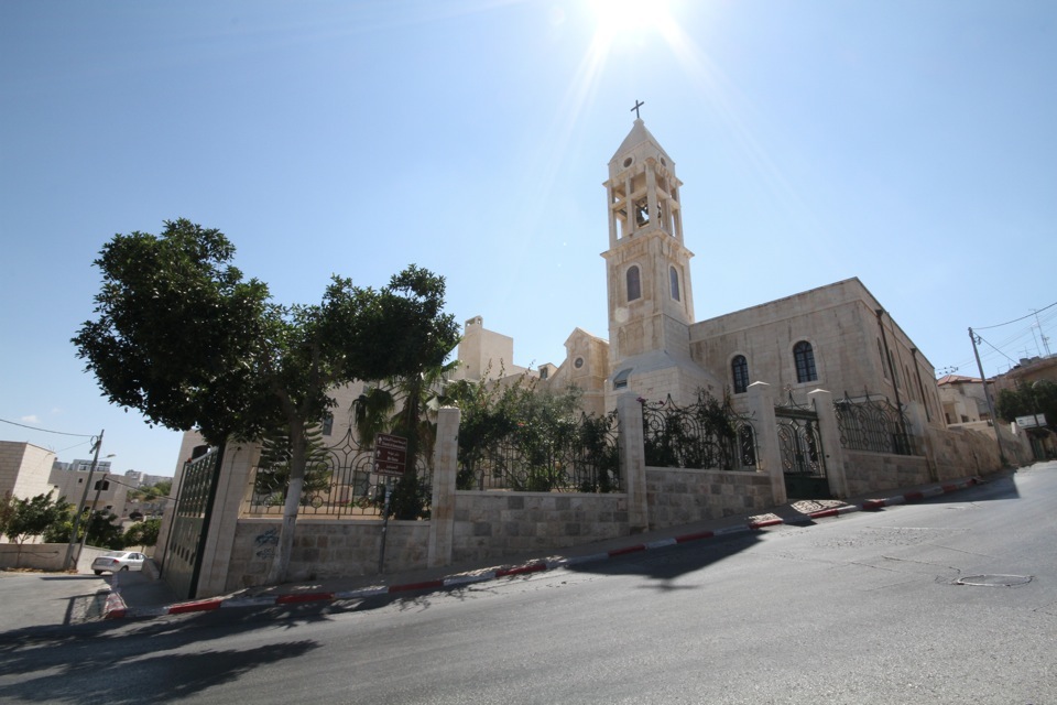
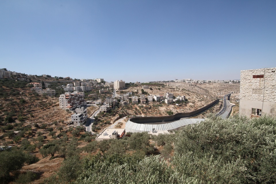
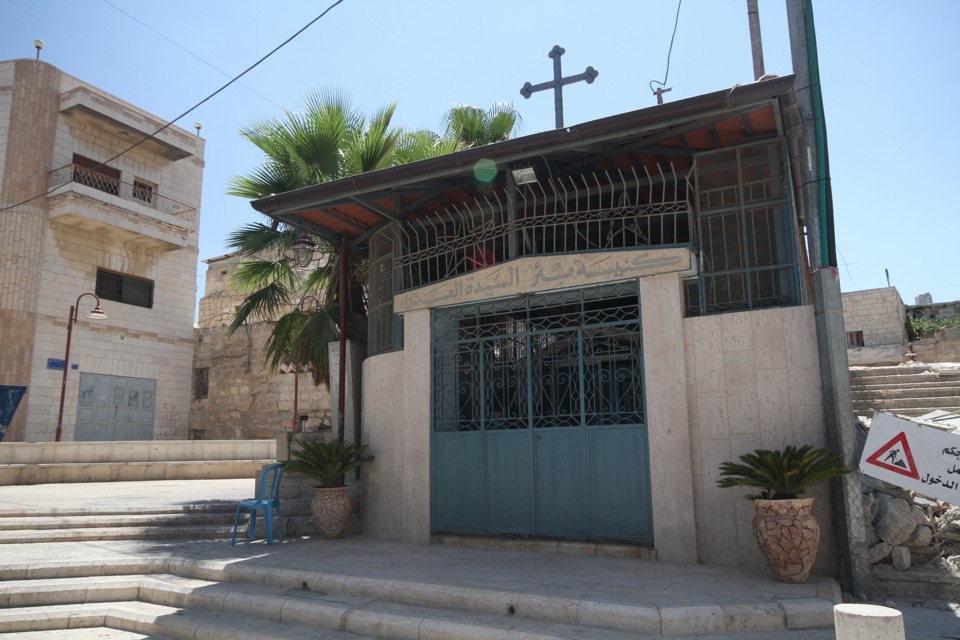
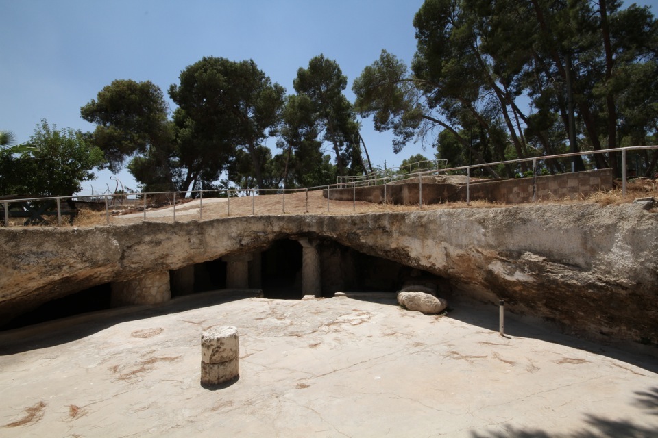

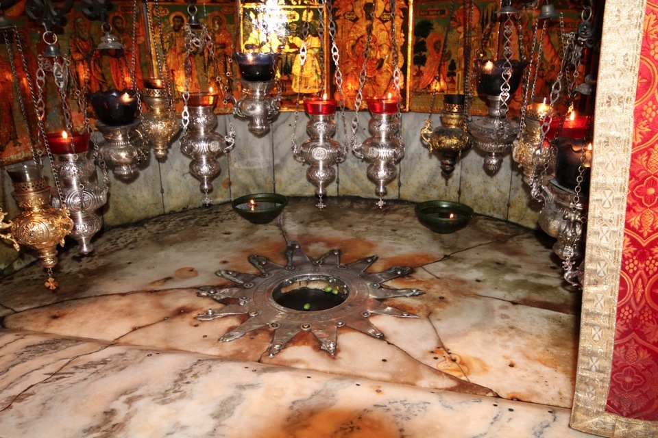
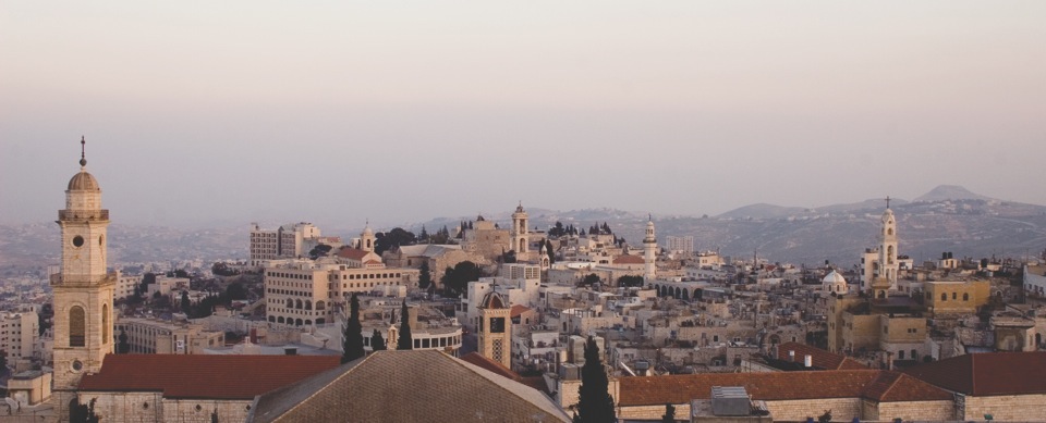
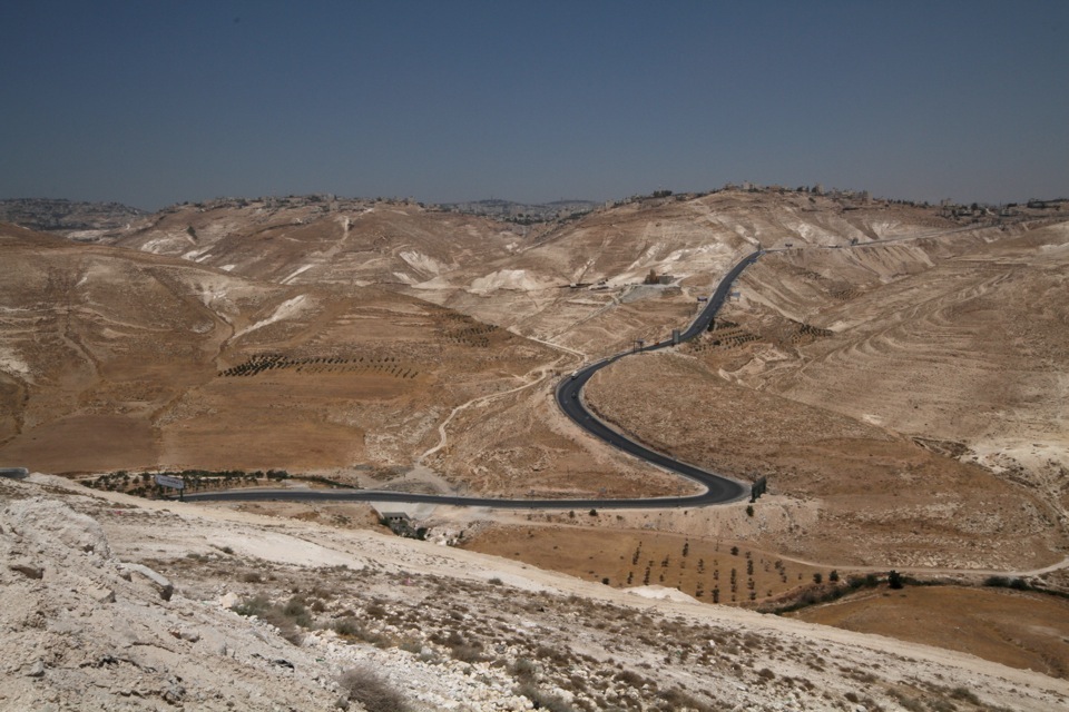
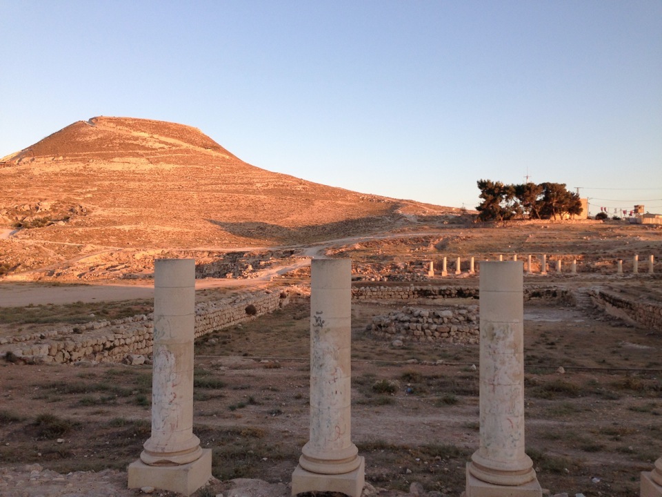
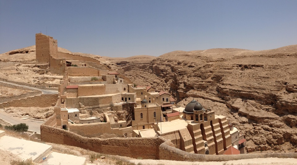
Background
Hebron is one of the first cities to develop in Palestine in the early Bronze Age. Islamic tradition holds that this was the first human establishment, where Adam and Eve lived after being driven from the Garden of Eden. The Biblical name of Hebron is Kiryat Arba, or the “Village of the Four,” said to be a reference to four Giants who fell from Paradise. Another explanation refers to four biblical couples said to be buried here: Adam and Eve, Abraham and Sarah, Isaac and Rebecca, Jacob and Leah. The “four” are equally interpreted as the four hills of Hebron on which the four Canaanite tribes settled, in a confederation, to establish the first city-state.
The Municipality of Hebron has 160,000 inhabitants, which makes it the largest city in the West Bank, after annexed East Jerusalem. The district of Hebron, (over 500,000 people) is the most urbanised region; 67% are city dwellers, while 30% live in the rural areas as villagers or Bedouins, and 3% are refugees living in al-Arroub and al-Fawwar refugee camps. In spite of the settlers in its centre, Hebron is a highly dynamic economic and industrial centre, with diversified manufacturing including stone quarrying. Its inhabitants have a reputation as entrepreneurs, known for their generosity and hospitality.
Hebron today is divided into two sectors after an agreement on the redeployment of the Israeli army, on January 15th, 1997. Sector H1 (80%) of the municipality of Hebron, is under Palestinian autonomy; sector H2, which includes part of the Old City including the Tomb of the Patriarchs / al-Ibrahimi Mosque, has in it some 40,000 Palestinians and 500 settlers, most of whom come from the United States, but also from France. The presence of these settlers, and that of the 4,000 soldiers (CPT figures) here to protect them, explains the tension in the city. Harassment of the Palestinian population and even journalists is frequent, as are acts of vandalism. In certain places, the boundaries are clearly indicated by fences, sometimes electrified, or more often by netting covering the streets (settlers occupy the upper floors there and throw many types of rubbish or detritus down onto these areas). In spite of the tense situation, foreign tourists receive as warm a welcome here as in all other Palestinian cities, and a tour around the city is guaranteed to be both educational and surprising. While visiting the small city centre, you will almost definitely see some of the various human rights defenders watching over the Old City and its Palestinian residents who are otherwise so vulnerable to violent settler attacks: Christian Peacemakers’ Team (CPT), the World Council of Churches Ecumenical Accompaniment Programme in Palestine & Israel (EAPPI) or Operative Dove, or TIPH, The Temporary International Presence in Hebron.
Things to see
The Old City
The Market (Souq) alone justifies a visit to Hebron. The ambience, architectural surroundings and the diversity of the goods sweep foreign visitors into a totally exotic world full of strong sensations. Above all, take time to observe, feel, discuss and take advantage of the choices on display in the stalls, if you are seeking original gifts.
Al-Haram al-Ibrahimi or Haram al-Khalil (Tomb of the Patriarchs), the oldest and most venerated monument in the city, the Haram is linked to the biblical account of the coming of the prophet Abraham to the region. The bodies of Abraham, Isaac and Rebecca, Jacob and Leah, as well as Joseph, are said to rest here. This cave has consequently become one of the most sacred sites in Palestine.
The Russian Orthodox Church (al-Moskobiya) was built in 1871 around an old sixteenth-century oak tree held up on supports. The Arabic name of the monastery is al-Moskobiya. The monastery not being open to the public, the only real attraction here is the tower in the garden outside, from which the view extends on a clear day to the Dead Sea.
People to meet
Hebron Rehabilitation Committee works to renovate the Old City, as well as to bring people back to live in this part of Hebron and thereby to improve living conditions here. This policy has given a new impulse to the Old City and allowed over 230 families to return to live here.
Library on Wheels for Non-violence and Peace Association is an association that runs a mobile library for children at over a hundred localities and offers programmes aimed at improving the general educational level through reading.
Hebron University Alumni Association: members of this association are from the city or its vicinity and are happy to welcome any foreign visitor interested in learning more about the city’s situation and the life of its residents.
Places to eat
Hanthala Café, typical Palestinian café situated in Ein Al Askar Square, which serves snacks, tea, coffee, and cold drinks.
Abu Mazen Restaurant, known for its stuffed meat dishes.
Geith al-Mashawi, serves delicious local specialties such as sweetbreads or giblets.
Places to sleep
There are only two hotels in Hebron:
Hebron Tourist Hotel, Malik Feisal Street, reasonable prices and located in the heart of the H1 city; Regency Hotel, northern entrance to the city, reasonable prices, two restaurants in the hotel, Palestinian and Italian, and a hammam.
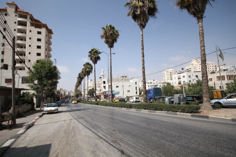
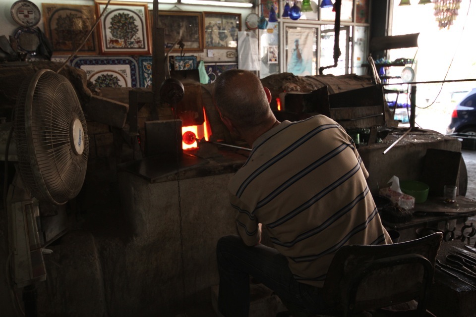

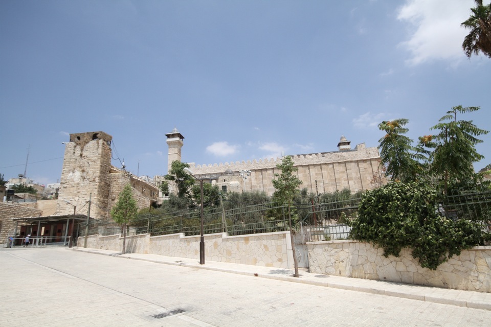
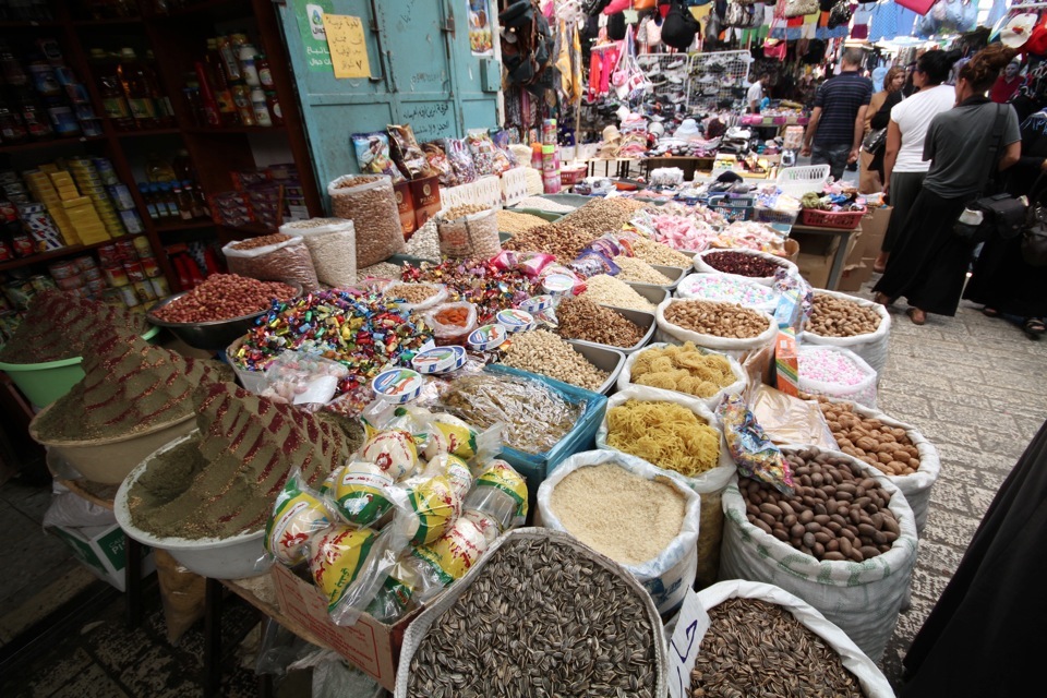
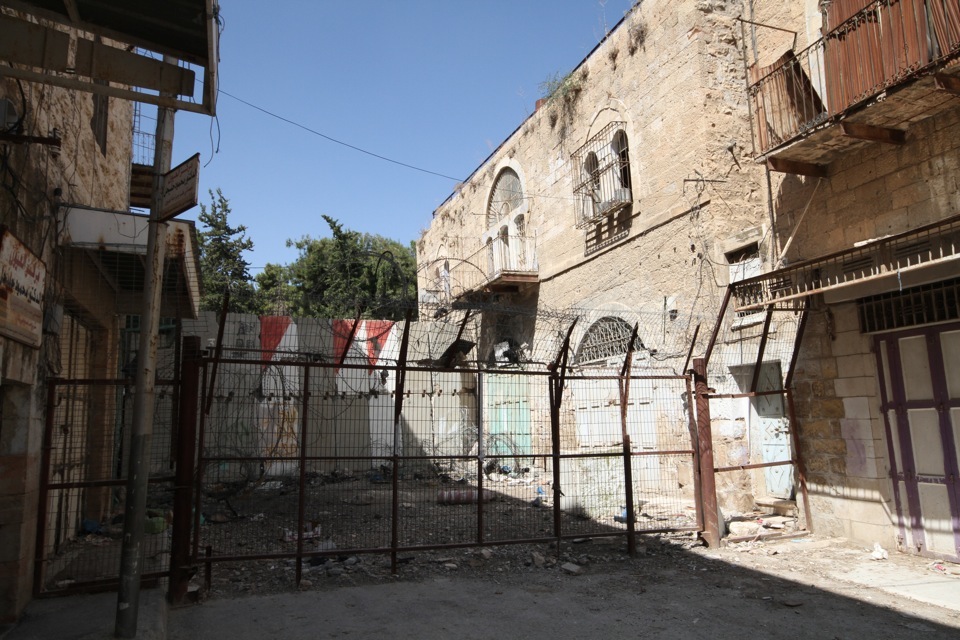

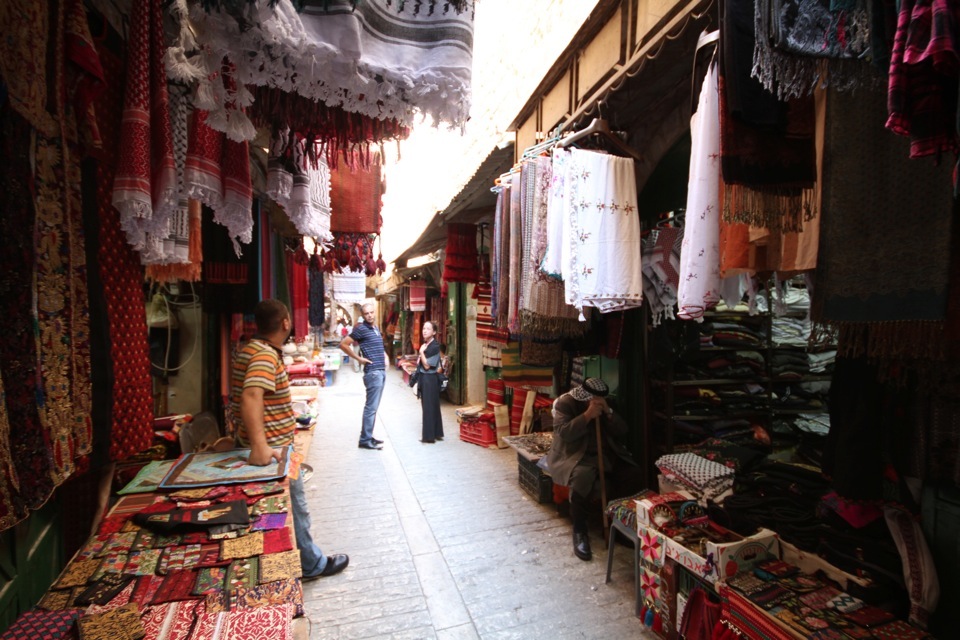
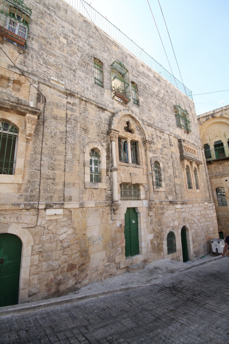
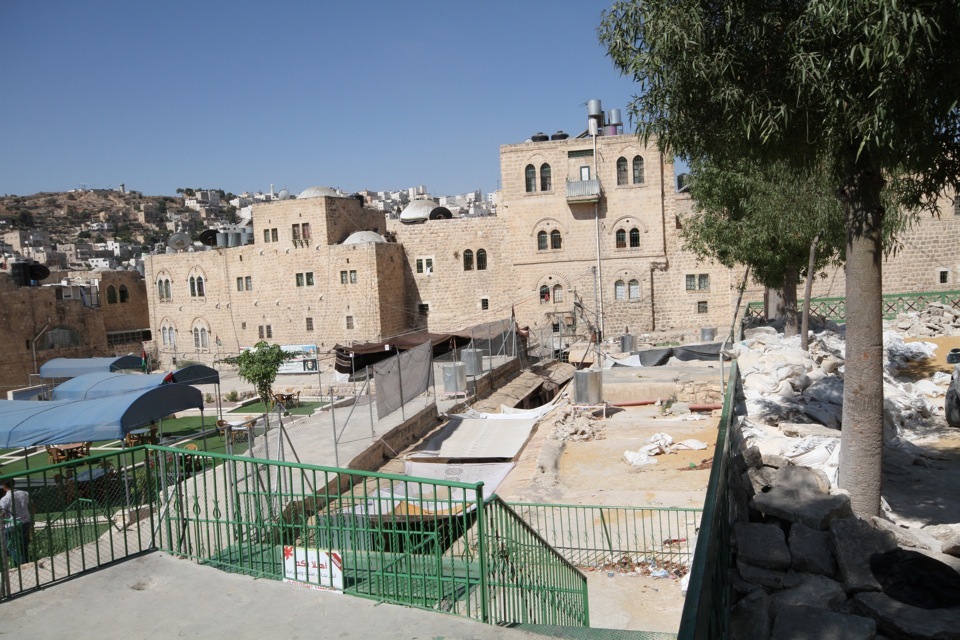
Background
Jericho is the oldest inhabited city on earth.
Jericho, “city of palm trees,” like its Arabic name Er-Riha, or “the perfume,” and the lowest city on earth, indicates the striking contrast the oasis makes to the surrounding desert; luxuriant greenery and fragrant flowers flourish here, its subtropical climate makes it an extraordinary garden, ideal for winter vacation.
Situated on the West Bank of the Jordan Valley, eight kilometres north of the Dead Sea, Jericho owes its fertility to cool, abundant springs.
Because it is near the Dead Sea, which is more than 400 metres below Sea Level, it stays warm throughout the year. It is a wonderful area for touring monasteries and historical sites, and for those who are hiking enthusiasts, Jericho has spectacularly enjoyable scenic routes.
When the Oslo (Oslo I) Accords were signed, Jericho became, in May 1994, the first Palestinian city in the West Bank to gain autonomous status, like the Gaza Strip. Despite frequent closures, the city invested heavily in tourism development. During the al-Aqsa Intifada, Israeli forces placed Jericho under a total siege. Nowadays, the city is open again to Palestinian and foreign visitors, with a small Palestinian checkpoint guarding its entrance. Occasionally, the Israeli army or Border Police mounts a “flying checkpoint” at the entrance to the city.
Things to see (in and around Jericho)
Jericho has many beautiful things to see. Walking around in the city of Jericho is exciting enough. Renting bikes and cycling through town is highly recommended in Jericho, as the city is very famous for its biking, although this is not recommended during the summer months (May-October) when temperatures rise to over 40o C.
Wadi al Qelt is a spectacular place for hiking. The landscape is exceptional, with unusual and varied fauna and flora. The route itself is relatively easy except for the heat.
The Monastery of St. George of Coziba, 5th century AD, was founded by St. John of Thebes, and became an important spiritual centre in the 6th century under St. George of Choziba. Located in Wadi Qelt, famous for its caves and cells where hermits used to live. A Greek Orthodox Monastery is open to the public to visit.
Nabi Musa, according to Muslim tradition is the burial place of the prophet Moses (Nabi Musa). The Nabi Musa compound is designed in a typically austere, impressive Islamic style; its buildings have two floors, surmounted by white domes, which stand out against the starkly arid surroundings.
Tel es-Sultan is irrigated by the Ein es-Sultan river; the ecosystem of this area made it an ideal place for early development of the first agricultural societies. The prosperity of the community and the building of a defensive wall (6m high with a tower 8.5m in diameter and at least 8m high) – unique at that time - have led experts to call Jericho “the oldest city in the world.”
Hisham’s Palace, 8th century AD, (a Muslim palace), was the most impressive country residence in the heart of hunting and farm land, so archaeologists call it “the Versailles of the Middle East.” The complex included a Palace, mosque, monumental fountain, and thermal baths.
The Monastery of the Quarantul (the forty) is perched on the side of the Mount of Temptation, offering a stunning panorama over the Dead Sea, Jordan Valley, and Jericho.
Deir Hijla (Saint Gerasimus Monastery): the monastery was built on the site where Jesus was baptised.
Khirbet Qumran is a site that has a reputation as the place where the Dead Sea manuscripts were discovered in caves in the surrounding cliffs.
The Dead Sea: except for very rare micro-organisms, neither flora nor fauna can survive in this lake, a fact which explains its name. Fish carried here by flood waters in tributary rivers die immediately because of the high salt and other mineral content. The Dead Sea lies at the lowest point of the great Afro-Syrian divide; it lies over 420m below Sea Level, and the surface of the Dead Sea is the lowest point on earth, its base being 800m below Sea Level. Moreover, at 330m deep, the Dead Sea is the deepest salt lake in the world. This huge salt lake extends over 76kms and measures 18kms at its widest point. The Dead Sea is unique for the high concentration of salt in its water; 30% compared to only 4% in most other bodies of salt water.
Environmentalists warn that the Dead Sea is dying or indeed dead, partly due to the lack of fresh-water inflow, but mainly due to the bromide industry, which has taken over on both sides of the shore (Jordanian and Israeli), especially the huge Israeli factories. Increasingly, there are huge problems as sink-holes have now appeared along its length.
Ein Feshkha is a site now far from the beach; located where the fresh water spring of Ein Feshkha comes down from the hills, this natural reserve is an ideal place for hiking.
Ein Gedi is an enriching place for walks, with its canyons, caves and waterfalls. There is a public beach here on the river.
Where to eat
Jericho has a wide range of restaurants. There are many inexpensive restaurants where one may find appetisers, salads, and grilled meat, but what really makes the reputation of the city is its seasonal fruit juices. Ein Es-Sultan Street, which leads to the historical site of old Jericho, is lined with most of the cafes and restaurants.
Recommended restaurants: Seven Trees, reasonably priced; Green Valley Park, moderate prices; Al-Khayyam Park, moderate prices.
An unusual place for dining is the Es-Sultan Panoramic Café-restaurant, suspended on the Mount of Temptation (a cable car is active to take you up)
Parks: Papaya Park; Banana Land; Spanish Garden Park.
Where to sleep
The Hisham Palace Hotel in the city centre has reasonable prices; the Jerusalem Hotel, more expensive, but still reasonable.
The Intercontinental Jericho (5 stars), and the Jericho Resort Village (4 stars).
Sami’s Youth Hostel
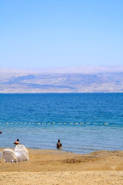
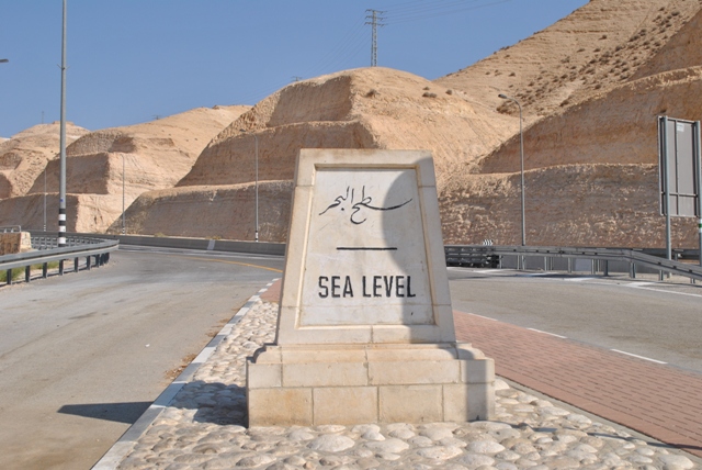

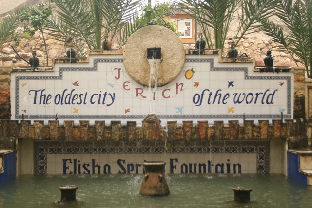

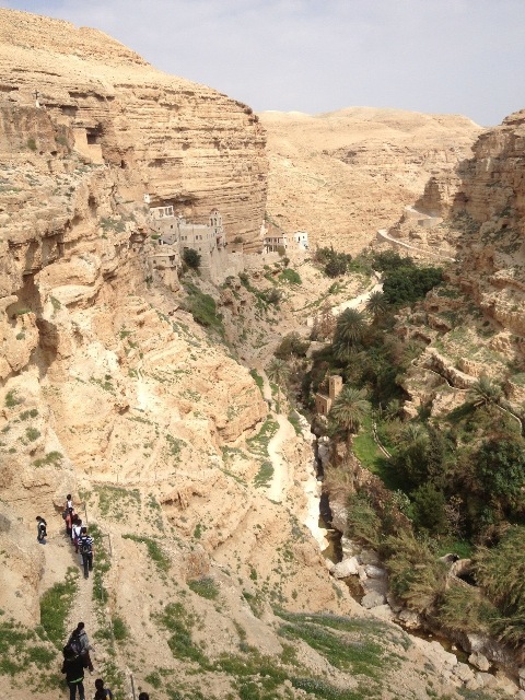
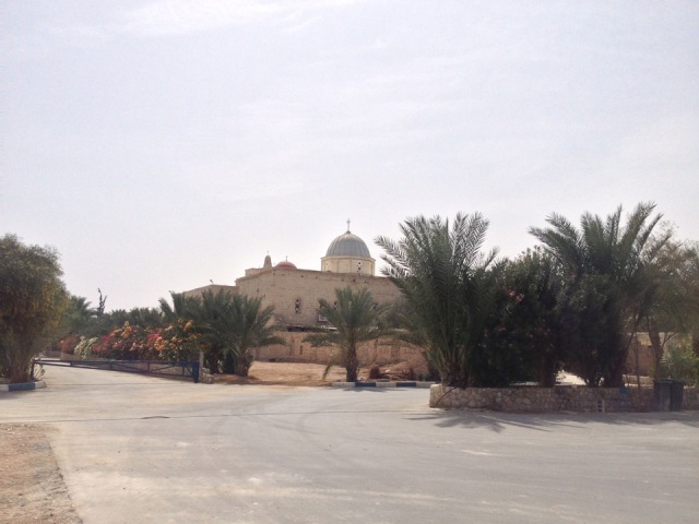
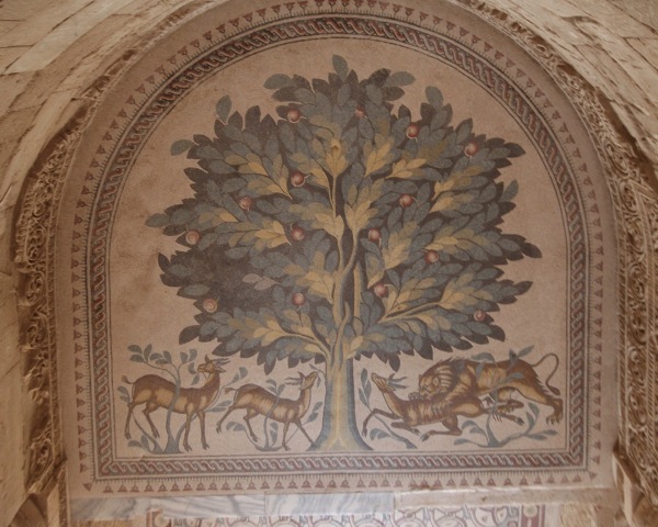
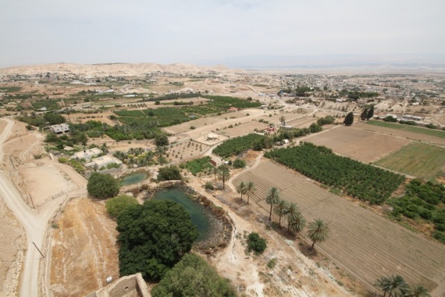
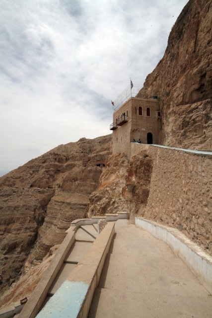
Background
The city of Nablus (population 134,000) lies in a narrow gorge less than a kilometre wide between Mount Jarzim (880m) and its counterpart, Mount Ebal (940m).
The old city of Nablus (Shechem) first grew around a spring under which now lies the Balata Refugee Camp.
In 1995, Nablus became an autonomous Palestinian city (Area A), but totally surrounded by Jewish settlements, including some of the most violent. The economic situation of the city, where there are many small manufacturers (furniture and construction materials, among others), is paralysed by Israeli restrictions on export and dependence on the Israeli market. Named the “mountain of fire” by Palestinians in allusion to its strong resistance, during the Al Aqsa Intifada the Israelis named it the “capital of terrorism;” they were merciless in their siege of the city, repeatedly bombarding it. After the Israeli army entered the centre of the city in April 2002, the population – already besieged by seven checkpoints around it – was subjected to a more or less permanent curfew.
Things to see
Sinjil
At the centre of the village, whose name is the Arabic version of the name of a Crusader monk Saint Gilles, is a very old mosque, originally a Crusader church, and a maqam known locally as Nabi Yahya, the cenotaph of the prophet Yahya (John the Baptist).
Al Casbah (Qasaba - the Old City).
Most religious and civic buildings here date to the Ottoman period, but one can find earlier architectural elements from the Mameluke, Crusader, Byzantine and Roman periods, hidden from visitors’ eyes in the later construction. Homes in Nablus are less ostentatious and more subtle, showing stones with crosswork. These historic buildings, and their labyrinth of tiny alleys running along the side of the hills, are a scene of intense activity and a flourishing business of numerous shops, small factories and other businesses often hidden behind an unassuming doorway, which it is rarely possible to experience. The Old City is a world unto itself with the varied colours and smells of its stalls and their fruits, vegetables, spices, za’tar (thyme), labaneh, tobacco and popular cafes, where distinctive scents come from the water-pipes or various workshops for mattresses, wool blankets, soap factories, the preparation of sesame oil, ground za’tar or sweets. Locals take pride in asserting that Nablus knafeh is the best in Palestine.
The Belfry
As with the belfries of Jaffa, Akka (Acre) and Jerusalem (at Jaffa Gate), this bell tower was built in the early nineteenth century, opposite the en-Nasser Mosque, to mark the thirtieth birthday of Ottoman Sultan Abdul Hamid II (1876-1909). To the south, the Diwan al-Jawhari building was the seat of the Ottoman civil administration.
Qaber (Tomb) of Sheikh Badr ed-Din
At No. 41, en-Nasser Street, west of the en-Nasser Mosque, there is a small, delicately executed window painted in green, behind which lies the tomb of Sheikh Badr ed-Din, one of Saladin al-Ayyubi’s officers. Nablussis (people of Nablus) have a tradition of lighting candles here to the memory of this holy man, during the month of Ramadan.
The soap factories of Nablus
It is easy to understand, after a trip around the north of the West Bank, why the industry based on olive oil, especially soap-making, was established in Nablus. Its production is renowned throughout the Middle East. In the Twelfth Century it was sold as far away as Europe. Despite the development of the modern cosmetic industry, Nablus soap is still widely popular in the Arab world because of its natural properties. At the beginning of the twentieth century, Nablus had some 30 soap factories. Today, many are still active and open to the public. A visit is particularly interesting and allows every secret of the manufacture of this pure soap to be seen, before the truly artistic drying process.
The Cardo and the Museum of Nablus
Remains of the Cardo, the principal road of the ancient city, were discovered inside the Zafer al-Masri School. The modest al-Qasaba Museum has on display artefacts from the city’s past. Another curiosity to see here is a flight of stairs constructed on the paved way, leading down into the underground aqueduct that supplied the city with water. According to popular legend, it was through this underground passageway that the troops of Saladin entered the city in 1187.
Jacob’s Well
Christian tradition has it that it was here that Jesus appeared to the Samaritan woman and announced for the first time that He was the Messiah. When visiting the church, do not hesitate to ask the monks for permission to see the private rooms where they burnt candles during the endless curfews during the First Intifada.
Qaber Yusef (Joseph’s Tomb)
The site has been a Muslim maqam commemorating a Muslim saint for a long time. In the 1980s, Jewish settlers occupied the site; even after Nablus and Balata Camp were declared a Palestinian autonomous zone in 1995, the tomb remained in the hands of the Israeli army and settlers. At the beginning of the al-Aqsa Intifada, the tomb became a stronghold of the Israeli army of occupation, an unbearable affront to the rights of Palestinians for their freedom. The shrine became a target for demonstrators, of whom 17 were killed here during the first month of the al-Aqsa Intifada. When the Israeli army was forced to withdraw, the tomb or more exactly the maqam, a symbol of all their pent-up suffering, was destroyed by the demonstrators.
Mount Jarzim and the Samaritans
Mount Jarzim, which is of great historical and spiritual importance, is home to the last Samaritan community, custodian of the most ancient religious tradition in Palestine and indeed in the entire Middle East. The Samaritans affirm themselves as the direct descendants of Moses’ brother, Aaron. They celebrate only the holy days mentioned in the Pentateuch, the most important of which is the Passover (Pesach), which commemorates the sacrifice of Isaac by his father Abraham, a sacrifice which Samaritans believe took place on the sacred Mount Jarzim and which Jews place in Jerusalem. On the seventh day of Passover, they make a pilgrimage (haj) up the holy mountain.
Mount Jarzim
A journey in a private taxi costs between NIS25 and NIS30 to see this magnificent panorama. The Samaritan Museum is in the centre of the village.
This mountain has a special sanctity for Samaritans, who consider it the first piece of land created by God (Har HaKedem means “the First Mountain”). They also believe that Adam was created from the earth of this mountain and that this was also the sole site spared in the Flood. Samaritans also revere Mount Jarzim as the site of the Sacrifice of Isaac, an event celebrated after elaborate rites held throughout Easter/Passover every year. The entire community comes to live in the village on this occasion.
Tel al-Far’a
This picturesque road through fertile land irrigated by two sources (Ein Far’a and Ein Duleib) leads to the Jordan Valley. No sign marks the ruins, but they are easy to locate: archaeological excavations have unearthed several interesting remains: a beautiful underground sanctuary at the far northern end of the site, where animal sacrifices were practiced between 1750 and 1550 BC; various gates and walls, including the original rampart of sun-dried brick, reinforced in later times with a slope of stones, are also visible; and house foundations of a popular neighbourhood which is separated by a rectilinear wall from a royal quarter.
The Village of Kur
To the west of Nablus, the architecture of the throne village of Kur has uniquely well-preserved Mameluke and, especially, Ottoman ruins. The excellent state of the buildings in this village is unique and gives a glimpse of social organisation during the Ottoman period. The simple peasant houses, each with its own courtyard, are overshadowed by three walled houses two or more floors high. One of these, which dates back to 1184 Hegira (1771 AD), belongs to the Jayousi family. Most of the old homes are now abandoned.
Sebastiya
Of all the visible ruins, the Roman era constructions are the most impressive. The central square at the old Roman forum, to the east, is now a parking lot. The basilica(68 x 32m) was divided into three naves, separated by a row of columns, some of which are still standing. To the north of the forum (the platform behind the restaurant), there is a view of what was the hippodrome, marked by a few columns. Behind the restaurant a path leads to the Roman theatre, which dates back to the beginning of the third century AD. It is believed to have been built on top of the ruins of the Herodian theatre. A splendid Hellenistic circular tower located behind the terrace is a fine example of Hellenistic fortification.
The Village of Sebastiya
The Sidi Yahya Mosque on the village square is a memorial to Saint John the Baptist. Its main building was built by the Crusaders circa 1160, in the Burgundian style. The remains of the Prophet Yahya (John the Baptist) are here in a burial niche between the tombs of two other prophets, Elijah (Elias) and Obadiah. Built in the middle of farmland, Sebastiya was a throne village in recent centuries, the residence of the powerful al-Kayed family, as attested by the huge three-storey home here which extends over 875 square metres around a courtyard of 100 square metres. The al-Kayed residence (Qaser al-Kayed, the Palace of al-Kayed) has a monumental entrance flanked by two symmetrical stone seats. The architectural details (geometric and floral decorations) give the edifice a special charm.
Jenin
For people interested in the history of place names, Jenin is a real treat: it is mentioned in various historical and mythical references as well as various travel chronicles. Located in the heart of fertile plains, Jenin was also at the crossroads of important trade routes.
Tel or Khirbet Belameh
The view from this site takes in the most fertile plains of Palestine, including Marj Bin Amer (the Jezreel Valley), a source of prosperity for the ancient city-states of antiquity. Under the ruins here, which are mostly Mameluke and Ottoman, on the hill opposite the contemporary village, lies the Bir es-Sinjil spring, whose water supplied the town from a tunnel carved into the rock. Notice the large Roman vault renovated by the Crusaders; the tunnel can be traced along 115 metres; it is 3.20 metres wide and from 3 to 7 metres high. The steps are cut into the rock, as are the small niches made in the walls for lanterns that lit the tunnel. Changes are being made in the tunnel to make it safe for visitors.
Burqin
Christian tradition has it that this village was the site of one of Jesus’ miracles, where He miraculously healed ten lepers (Luke 17:11-19). Saint George’s Church was built over an ancient Roman cistern where Jesus performed the miracle. Mass is held only once a month for the Christian community in the village. The gates of the church are usually locked, but villagers are happy to allow visitors to enter the church. The grotto and the small chapel in the church give every appearance of having been in existence since the early days of Christianity.
People to meet
Bassam Shaka’a is a former mayor of Nablus, happily available to any individual or group to share his knowledge and experience.
En Najah National University: the university was inaugurated in 1977 and has constantly developed the range of its educational facilities, especially in the faculties of medicine and science. Nearly 10,000 students study at the Najah University, making it the largest university in the West Bank.
The Committee for the Defence of Palestinian Refugee Rights and the Yaffa Cultural Centre was established in 1998, it offers many cultural and educational activities, including courses in computer literacy. It gives visitors the opportunity to learn more about the situation of refugees and their aspirations.
Centre for Women’s Activities was established in 1975 to answer the specific needs of women. It provides training in different areas such as sewing and hairdressing, and a computer project is planned. There are also literacy courses and seminars on health, human rights and religion.
Darna is a development centre for youth and civil society initiatives. Their objective is to strengthen the sense of identity among young people in Nablus and the surrounding area, and to develop participation of youth in the community. Darna also promotes exchanges between Palestinians and Europeans, and arranges home-stays for foreign visitors, with local families in Nablus.
Where to eat
Al-Aqsa and Halawiyat Arafat have excellent reputations for pastries and sweets.
Al Madafa Café, where there are usually cultural evenings.
Roof Laiali Zaman has a panoramic view and pleasant setting.
Salim Afanid Restaurant serves excellent traditional dishes.
Zeit Ou Za’atar restaurant is one of the few that serves alcohol in Nablus.
Where to sleep
Al-Yasmeen Hotel is Nablus’ hotel with the most character. It has a central location in the heart of the casbah and has a very pleasant café-restaurant.
Chrystal Motel, located outside the Casbah: the hotel is beautifully maintained and its rooms are spacious, well-furnished and new.
Al Istiklak Hostel is ideal for male travellers on a low budget who don’t mind minimum comfort.
Asia Hotel and Qaser Hotel, located in the Rafidia neighbourhood; both are modest but comfortable.

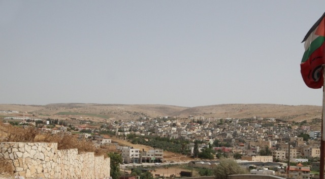
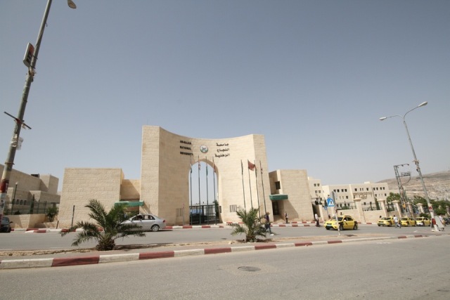
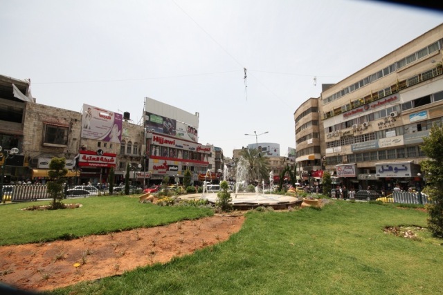

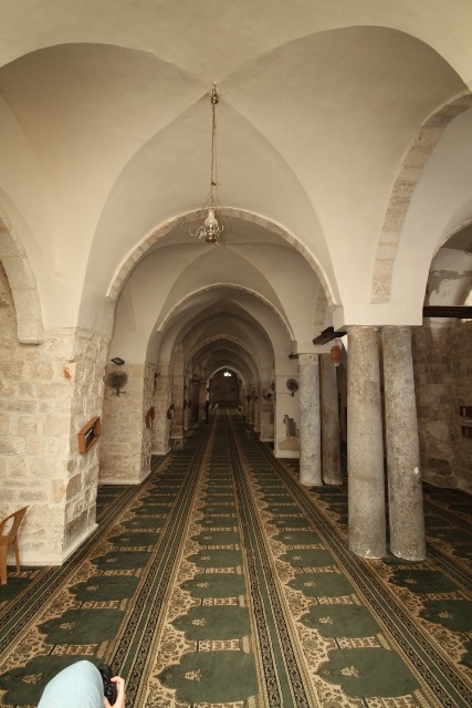
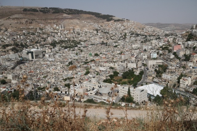
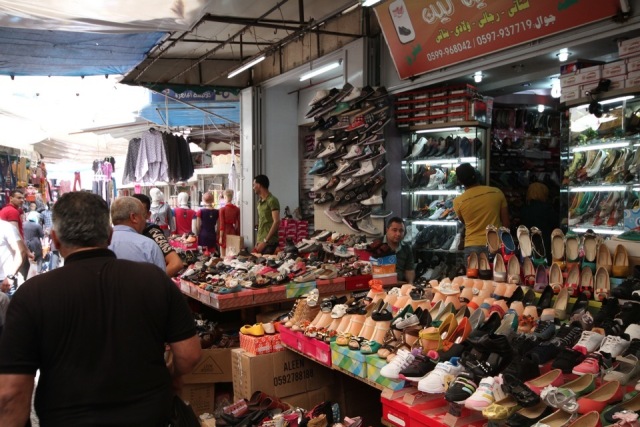
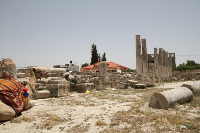
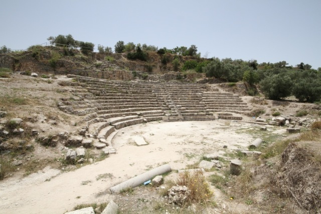
Background
Ramallah (“Allah’s Mountain” in Arabic - at an altitude of 860m) and al-Bireh (bir means “well” in Arabic) were once two distinct villages, but have grown together into a built-up area of over 60,000 inhabitants; the entire district of Ramallah today has more than 200,000 inhabitants. Since the Palestinian Authority (PA) took office in December 1995, the district has evolved as the administrative, cultural and political centre. It has known the same urban growth as other autonomous Palestinian cities, but the development in Ramallah has had a particularly marked cultural and recreational flavour.
Things to see
Tel al-Nasbeh, a walk along the hill is especially interesting for an overall view of recent urban development in Ramallah and al-Bireh.
The Crusader Church has been thoroughly excavated by archaeologists; Christian tradition has it that this was where Joseph and Mary lost twelve-year-old Jesus praying in the Great Temple there on their way to Jerusalem.
Beitin (population 3,000) is now a residential village near Ramallah on the slopes of what was once a flourishing city of religious importance. Among the rare ruins of the Old City still visible today are the Hellenistic tower, the church and Byzantine monastery in a place called Roujm Abu Ammar.
Tel et-Tal (Ai - or Tourmos Aya) , the site is found on a small hill, dominated by the village Deir Dibwan; remains of the Bronze Age wall, and houses dating back to the Iron Age, can be seen on the site. But doubtless it is the rural setting which enchants visitors most; in the spring, the green countryside is, for hikers, an enticing invitation hard to resist.
Taybeh is a village with a population of 2,100 people, most of whom are Christian. The traditional peasant homes inside the fence around the Roman Catholic (Latin) parish property shows that Christians and Muslims shared exactly the same way of life. The al-Khader Church, originally Byzantine, then rebuilt by the Crusaders, was abandoned at the end of the Crusaders’ occupation. Now in ruins, it is still an object of special devotion where sacrifices are placed on important occasions such as the return of a native of Taybeh from abroad, or the birth of a new baby.
Nadim Khoury founded the Taybeh Beer Brewing Company in 1995, the only beer company in the Middle East. Taybeh is a high quality natural beer praised by connoisseurs and up to the standards of any German beer. Taybeh beer (taybeh also means “delicious” in Arabic) is found in all Palestinian cafes serving alcohol.
Jifna is a small village with a Christian majority, famous for its annual apricot festival. An old fortified house of the Ottoman period, al-Burj, recently renovated, houses a cultural café-restaurant where there are conferences, musical evenings and other recreational activities. It also has a museum and exhibitions.
Birzeit has a population of 6,600 inhabitants. It is a lively place, thanks to its proximity to the university. There are restaurants, internet cafes, shops and chemist shops, as well as a hostel for foreign students and many rooms for rent. The countryside around Birzeit is beautiful and an ideal point of departure for walks or hikes. With luck, you may surprise gazelles, partridges or even foxes in these stunningly beautiful countryside surroundings. Have a look at the many dry stone constructions which you will find scattered around the farmlands. These constructions on two floors are known by the term qasr or mantara.
The Birzeit University was officially inaugurated in 1976. To this day, the Occupation authorities have not ceased to affect life of the university and students. Between 1979 and 1992, the university was closed 75% of the time. Today, the Israelis no longer issue closure orders since the university is considered to be in an autonomous zone (”Area A”). However, the army controls all access routes.
Bil’in is a small agricultural village of 1,700 residents, located north-west of Ramallah, just east of the Green Line. For four years the village has been struggling to exist and because of its perseverance, and thanks to the supportive solidarity of Israeli and international activists, the struggle of Bil’in has become a symbol of joint non-violent resistance in Palestine and abroad. Every Friday the residents of the village peacefully demonstrate against the Wall that has been illegally built on their land, challenging the Israeli policy of annexation, which has already caused the loss of almost 60% of land around the village. The Supreme Court of Justice in Israel ruled that the village should receive some of its lands back, by a re-routing of the Wall, but most of those lands had already been built on by Israeli colonists, religious Orthodox Jews. The struggle of Bil’in is well recorded in the Palestinian film “Five Broken Cameras” which was filmed by Imad Burnat of the village, over a period of years, and edited together with Guy Davidi, an Israeli director; the film was short-listed in 2013 for an Oscar.
Latrun is fourteen kilometres from Ramle; the small Christian village of Latrun had 190 inhabitants in 1945.
The Domain of Latrun: Latrun Abbey is renowned for its wine production and has its own shop where Latrun wines or liquors are sold. The abbey was built at the end of the nineteenth century by French Trappist monks, who founded a hospice for pilgrims and an agricultural school here. The gardens and vineyards are open to the public. On the abbey’s lands on the top of the hill are the ruins of the Crusader fortress: the Tower of the Knights, which was constructed in 1133.
People to meet
Al-Qassaba Theatre and Cinema - Films shown here are largely recent Hollywood productions, but there are occasional exceptions. Theatre here is more original than films and proves a unique occasion to watch a play despite the language barrier. There is a pleasant café-restaurant.
Al Sharqi Turkish bath - Take a break here and emerge feeling relaxed and refreshed.
Khalil Sakakini Cultural Centre - This centre promotes the visual arts and Palestinian heritage, past and present, with exhibitions of painting and photography, concerts, documentary films, historical information and on-going workshops for children and adults.
Popular Art Centre was established in 1987 by the al Funoun esh-Sha’abiyeh Palestinian Popular Dance Troupe. It has a leading role in organising cultural activities and events; it initiated the Day of Cultural Heritage celebrated annually on 7th October. Among its activities, the centre organises music and dance festivals, workshops for children, folk dancing (Dabke) courses, jazz, music, puppets and drama and ensembles of traditional Palestinian music. The centre sells audio and videocassettes produced by it, especially of the superb performances of the al-Funoun Troupe. The art centre also houses a cinema which screens international films.
Ramallah Cultural Palace hosts music, dance, theatre and film programmes.
Addameer (“conscience”) – Prisoners Support & Human Rights Association: Provides legal and moral support for Palestinian prisoners. Such support may include visiting the prisoners, following up their cases with their families, launching support campaigns and protests and working to end torture through monitoring and legal procedures.
Al-Haq Association (“the right”) is affiliated to the International Commission of Jurists in Geneva, Switzerland. The association documents violations of basic human rights in the Occupied Territories, publishing studies on Israeli violations of international law and giving legal assistance to Palestinian victims of violations committed by the occupation authorities. It also addresses itself to abuses of human rights by the Palestinian authorities.
DCI-PS- Defensc for Children International, Palestine Section: DCI was established in 1992. It concentrates its efforts on legal and social aid for children and gathers evidence on situations of Israeli violations particularly related to child rights: curfew, assassination, shelling of civilian homes and schools, imprisonment and torture.
Palestinian Association for Cultural Exchanges (PACE): This association organises tours to sites of archaeological and historical interest, as well as urban and rural areas in the West Bank and Gaza Strip. The main focus is on the daily life of Palestinians living under occupation, which is the customary alternative tourism approach. Individuals can join PACE tours offered on its weekly calendar. One of the most original tours is a visit around Nablus followed by a cultural evening in the hammam.
Women’s Associations: Women’s Affairs Technical Committee (WATC) works for women’s empowerment on different levels through lobbying and networking, and is establishing a “National Government Body for Women.” Various training courses are offered here.
Where to eat
Ramallah has lots of cafés and restaurants.
Zyriab café is a café-gallery in Rukab Street which features figurative art, and is owned by a co-operative of Palestinian artists.
Al-Asseel, on the top floor of Tannous Building. Spacious and with a view over the main street, it has live music on Thursdays and Fridays. No alcoholic beverages are served.
Zan Restaurant Bar, next to the Kasaba theatre, offers an international atmosphere, a variety of local and international dishes and live music.
Diwan Café-restaurant is located in an old traditional residence, with an extremely beautiful interior.
Pronto (Italian cuisine) and Stones, around the al Muntazah Park, are both original and good.
Sheish Beish, a tiny café, should not be missed; it’s an ideal place for a traditional breakfast.
Stars and Bucks café is a fancy café and restaurant in Manara Square, with other branches elsewhere.
Antika’s, Main Street, is a self-service restaurant
Fawanees, Ministry of Culture Street, serves delicious garnished bread.
Laiali Falistine restaurant, Ramoun Building, 2nd floor, serves traditional Palestinian dishes.
Za’arour Barbecue, behind the municipality, serves Palestinian appetizers and good quality grilled meat.
Muntazah, serves Palestinian appetizers and quality grilled meat.
Neferteti, Post Office Street, has a good moloukhiya and musakhan.
Angelo’s, La Strada, pizza cooked over a wood fire.
Chinese House Restaurant.
Almonds has a good variety of international dishes and beverages.
Darna, opposite the Melkite Greek Catholic Church, offers fine Palestinian dining in a grand setting: a renovated stone villa with high ceiling archways and shaded patio, this is one of the favourite haunts of diplomats and INGO personnel, as well as the Ramallah elite, who can afford its high prices, and high standards.
Eiffel Sweets, Damascus, and Jaffar, are the best places for traditional Palestinian sweets such as baklawa and knafe.
Where to sleep
The City Inn Palace Hotel, Jerusalem Street, is comfortable, in the city centre of Ramallah.
The Grand Park Hotel, Al Masyoun Heights. This luxury hotel is a favourite for international diplomatic delegations.
Al-Wihdah Hotel, al Nahda Street. The rooms are clean and spacious and this is the least expensive hotel in the city.
The Merryland Hotel, Al-Ma’ahed Street, is a good value hotel and also in the city centre.
The Moevenpick Hotel is the favourite five star hotel for international travellers, diplomats and INGOs.